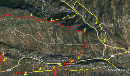
Walk Seventy Eight. Penina Circular. 14k. Acent 600m. With Extension of 3.4k. Ascent 150m. GPS: 37/ 14.57.97 8: 06.52.61
This walk takes in one of the most popular climbs and views in the Algarve, as well as some very pleasnt valley walking and one other fairly steep ascent. Rocha da Pena is rightly celebrated as perhaps one of the best high-level walks in the region, without expending too much effort to get to the plateau and the panorama. The walk takes you the whole way along it and down a steep, rocky descent at the eastern end.. The start is in the tiny hillside village of Penina, which is attractive in itself. There is a bar in the village, and one other place of refreshment along the way.
Getting to Penina.
The easiest route is to make your way to Benafim on the N124. Drive to the roundabout at the eastern end of the village.. From east and west, Penina is signed from here. From the south, go straight across at the roundabout. After about 1k, bear right off the main road, signed to Penina. Reaching the village, see a small shaded seating/picnic area in front . Park on the roadside here. The bar is uphill to the left and round the corner on the left.
The Walk.
From the bar, turn left and immediately right. At the T junction turn right and begin to walk uphill. The houses of the village are soon left behind, and a steep climb begins. After 350m, the track swings round to the right, and the ascent gradually becomes less steep, though the track surface is very stony. After another 900m, reach level ground, and on the right see a finger post indicating a route to ´Trafele´. This is a trig pillar with a fine view, worth a short detour if you have not been up here before. (2). Returning to the main track, turn right and continue as it rises a little more. After another c400m, the path becomes much narrower and winding. Another 400m along, afteer climbing up a rocky slope, come to the end of a very large wall of stones that stretches away to the left. (3). (The origins of this wall are much disputed). Descent from here, still on a narrow path, and after 550m, come to a point where a wider track comes up from the right, with a finger post pointing along it, downhill. (4) Walk on past this point. Very soon the wide track turns left to cross the plateau, but you continue ahead on a much narrower path once more, for a further 200m, reaching the eastern end of Rocha da Pena.(5)
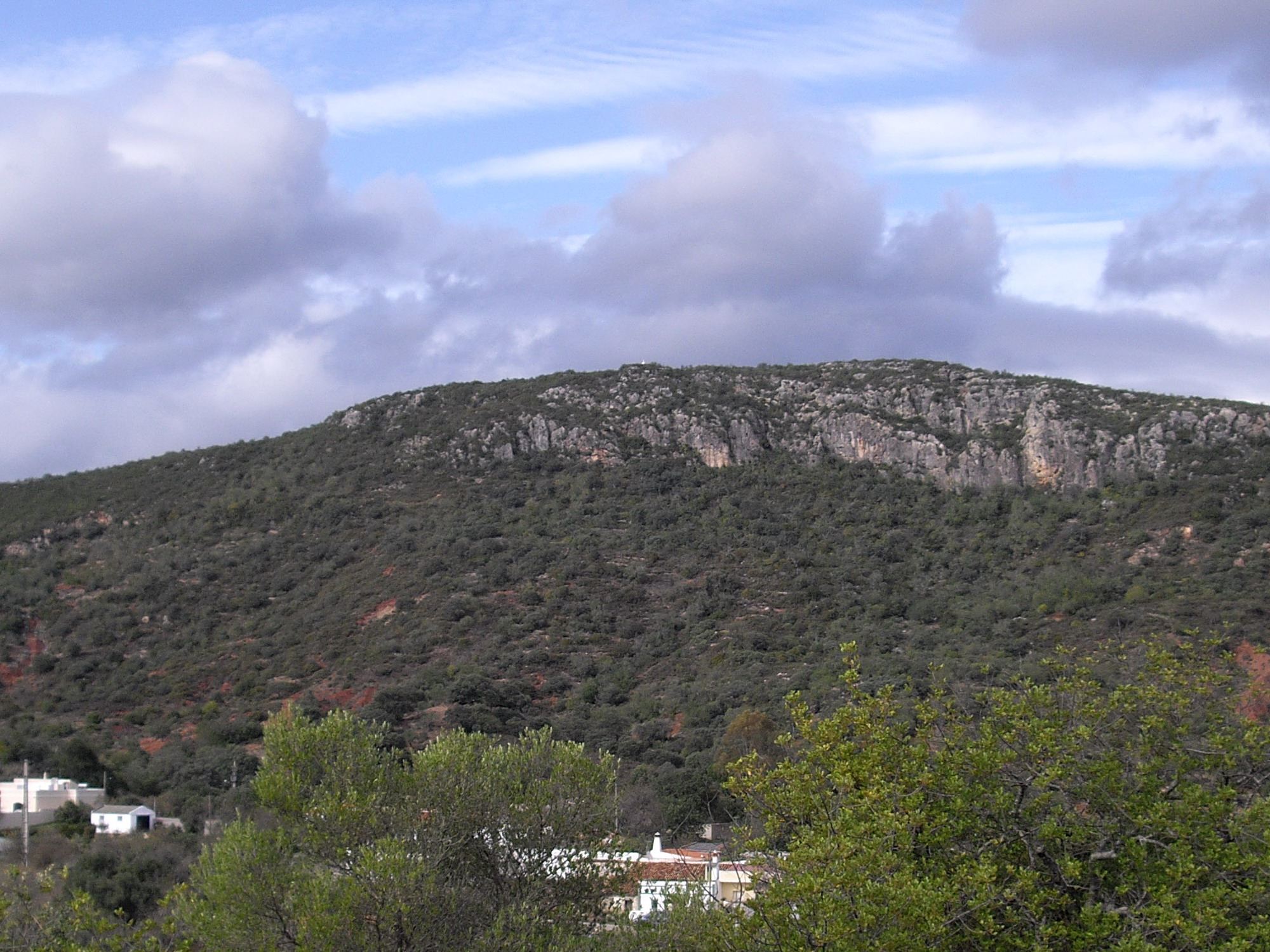
View of Rocha de Pena from the south.
Look to the right to find a steep and rocky path leading downhill. (5)This descent is not easy, and requires great care. After c170m, the path turns east long the hillside, and after another 240m arrives at a junction with a wider track. Turn right and descend to a dirt road. Turn left and walk down gently to a pair of ruined windmills. (6).(This is where the extension begins). To follow the main route, continue past the windmills for 280m. As you round a sharp right-hand bend. see a path leading off on the left. .
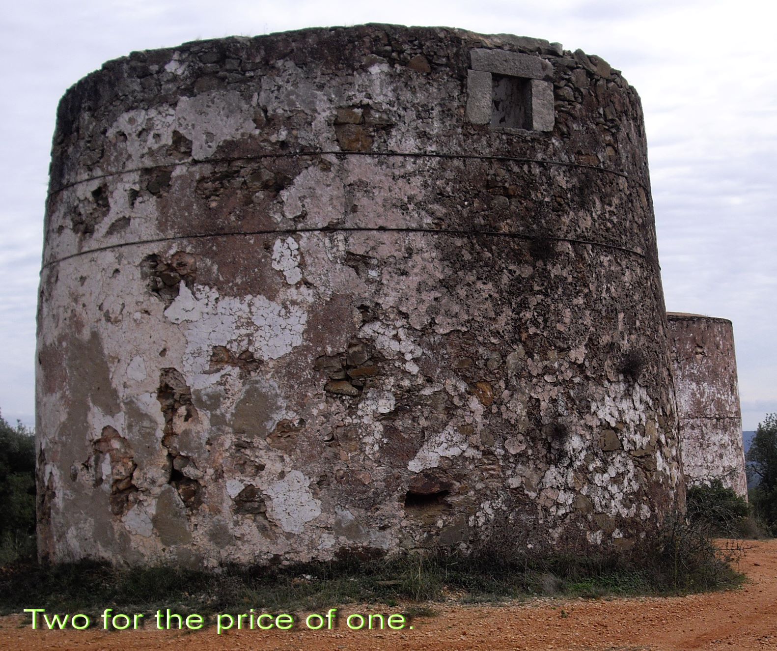
Ruined Windmills, east of the Rocha.
The path contours the hill for a time, then descends a little more steeply. After 830m, come to a 90 degree turn to the right, (7) and descend quite steeply to a tarmac road.. Go straight across and follow the track on the other side as it meanders across the valley floor for around 570m, to reach a narrow tarmac road. (8). Turn right and walk into the tiny settlement of Casa Martins Anes. Take the second turn to the left in the hamlet, which leads you very shortly up to a wide main road (the N124) (9). Turn right along the road for 240m, and then find a narrow path up through the woods on the left, turning back sharply left. After 130m, emerge onto a narrow tarmac road and turn right. 230m along, find a faint track on the left at an acute angle to the road, (10) and follow it over a slight rise, and then down to a walled lane below. Jump down into the lane and turn right. This is where the extension ends. NOTE. If you miss the faint track, there is a wider one a few metres further on).
After 140m, come to a cross-tracks. (11). (Here begins a short cut, if you wish to cut out the second main climb of the day). To continue on the main route, turn left and follow the wide track downhill. After 520m, find a track on the right leading straight across the valley southwards. (12). Follow this track for 350m to point 13, after which it begins to climb quite steeply south-westwards. (13) The climb goes on, in two stages, for just over 700m. Come to a junction with a track on the right at the top of the climb (14) Take this track and walk for almost 500m. Look for a narrow track leading off on the right, almost due north. (15). (There is a track on the left opposite the same point). Follow this track over the edge of the plateau and downhill. After around 300m, come to a junction with another track coming downhill, and follow this due north all the way to the valley floor. (570m.) (16)
Walk due north on vehicle and farm tracks for 350m across the valley. Come to a more obvious cart track running east-west and turn left. After 250m, come to a junction of paths. (17). Turn right and immediately left to head north-west. Stay left at a junction after 260m, then after another 430m, turn right off this clear track onto a field path. (18). (there is a gravel path coming in from the left at the same point.). Plot a course due north from here, picking up a cart track after a couple of field lengths. After 260m, emerge onto the N124 main road.. Turn left, and after only a few metres, cross the road and find a narrow path leading off uphill, again due north. Follow this carefully, avoiding straying to the left. After almost 300m, come to a cart track running east-west. (19).
Turn left and walk just north of west for 100m, then turn right and cross through a broken wall. Now bear left and walk round the left hand end of a series of old terrace walls. When you reach level ground, turn north-easterly on a cart track and soon come to the beginning of a clear track, heading downhill, with a farm building at the bottom. Walk down to the first sharp bend (100m), then take the rather overgrown path straight ahead, which avoids the farm and leads to the valley floor. Bear left at the bottom, and soon come to a track crossing your path. Turning right along it will take you to a tarmac road, and you can walk along it straight back to Penina (1.2k)
If you prefer to stay off the road, cross the track and head due west across the fields for another c180m. Find a sunken track running across your path, and drop into it, turning right. (21). After around 100m, as the track turns towards a farm building and the road, bear left along a narrower path. After 100m, turn right and then very shortly left to continue along the field path. Now simply follow this path, which can get grassy and quite overgrown (not with prickly things), for just over 400m. The track becomes wider and more obvious towards the end, finally rising to meet the tarmac road into Penina, only a few hundred metres away.
The Extension
From Point 6, walk round to the left of the windmills, and find a footpath heading due west, down into the woods.. After around 370m, (1a) it meets a wider forest track, and winds down, emerging at a tarmac road with another tarmac road leading off on the left, signed to Brazeira. Turn left here and after 100m, turn right on a track leading off north-easterly. (2a) After just over 200m, come to the bottom of a steep rise, and bear right on a less obvious track. After a short distance join a wider track coming in from the left (you have simply avoided going up the hill to come down again!). . Now follow this undulating track through open country for just over 800m, then join a track coming down from the left, bear left and walk down for 160m to a tarmac road. (3a)
Turn very sharp left here and walk for around 180m on tarmac. Come to a point where a rutted dirt track leads off uphill on the right, and take it. The track bends round to the left at the top of the rise, and follows more or less level ground for 160m before descending slowly, with a small barragem on the right. Now head almost due south for 200m to meet a wider dirt road at a sharp bend. Turn right and follow the road down through a group of houses to a junction with a tarmac road. Turn left here, and after 100m, turn right into a narrow lane. (4a) ((If you want refreshment at this point, there is a cafe another 100m along the road). Follow the lane for 500m to arrive at a main road (the N124.) Turn left and after 120m, cross the road and fork right onto a narrower tarmac road.
After 350m, come to a junction and turn very sharp right. into another tarmac road. (5a) After 170m, fork left onto a dirt road. After 600m, stay left at a junction, and after almost another 1k, come to a track junction (6a). You are now back on the main route. Stay left to come to point 11 after 130m.
Short Cut from Point 10 (Casa Martins Anes)
From Point 10, instead of turning left, continue through the hamlet and walk along the track for almost 900m, to arrive at Point 17. Bear right at the track junction, and follow the main route from there.
GPS Points (37/8)
| 1 | Penina Bar | 14 | 58 | 89 | 06 | 52 | 31 | |||
| 2 | Trafele turn | 15 | 16 | 96 | 06 | 34 | 08 | 1.28k | ||
| 3 | Wall end | 15 | 16 | 14 | 06 | 00 | 27 | 880m | ||
| 4 | Wide track | 15 | 14 | 06 | 05 | 40 | 36 | 560m | ||
| 5 | Top of descent5 | 15 | 14 | 15 | 05 | 28 | 18 | 300m | ||
| 6 | Windmills | 15 | 09 | 35 | 05 | 06 | 38 | 700m | ||
| 7 | Turn right | 14 | 57 | 98 | 04 | 27 | 37 | 1.1k | ||
| 8 | Turn right | 14 | 31 | 65 | 04 | 36 | 90 | 970m | ||
| 9 | Turn right | 14 | 29 | 08 | 04 | 45 | 49 | 370m | ||
| 10 | Bear left | 14 | 26 | 53 | 04 | 56 | 49 | 710m | ||
| 11 | Turn left | 14 | 24 | 25 | 05 | 07 | 13 | 220m | ||
| 12 | Turn right | 14 | 12 | 99 | 04 | 55 | 24 | 580m | ||
| 13 | Bottom of hill | 14 | 01 | 97 | 04 | 53 | 86 | 360m | ||
| 14 | Top, turn right | 13 | 40 | 70 | 05 | 02 | 01 | 760m | ||
| 15 | Right off track | 13 | 42 | 29 | 05 | 21 | 56 | 500m | ||
| 16 | Valley floor | 14 | 08 | 96 | 05 | 43 | 40 | 1.26k | ||
| 17 | Right and Left | 14 | 20 | 35 | 05 | 40 | 75 | 400m | ||
| 18 | right off track | 14 | 17 | 35 | 06 | 03 | 34 | 700m | ||
| 19 | Turn left | 14 | 34 | 66 | 06 | 03 | 74 | 600m | ||
| 20 | Top of slope | 14 | 20 | 21 | 06 | 04 | 23 | 280m | ||
| 21 | Into lane, turn right | 14 | 44 | 44 | 06 | 19 | 62 | 400m | ||
| End | 970m | |||||||||
| 1a | (left at windmills | 15 | 12 | 03 | 04 | 50 | 52 | 380m from 6 | ||
| 2a | Right off road | 15 | 22 | 59 | 04 | 38 | 51 | 760m | ||
| 3a | Sharp left | 15 | 05 | 50 | 04 | 11 | 81 | 1.22k | ||
| 4a | Right off N124 | 14 | 43 | 88 | 04 | 02 | 35 | 1k | ||
| 5a | Sharp right | 14 | 22 | 02 | 03 | 53 | 42 | 950m | ||
| 6a | oin main route | 14 | 24 | 99 | 05 | 01 | 84 | 1.75k |
Photo 1. Whole route with Extention.
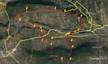
Photo 2. Extention.