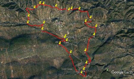
Walk One. Salir Roundwalk.21k Ascent:750m GPS:: 37/8 14.25.71/ 01.21.42
This walk is an extension of two or three others in this series, It describes a wide, irregular circuit of the small town of Salir, fifteen minutes driving north of Loule.It starts from a small bar at Ponte de Salir, a short distance from the town itself. The first part is a valley walk to the west., after which the trail turns towards the hills on the northern side of the town. A longish stretch on a quiet country road ends with a climb to the first ridge of the hills before descending again to cross the main N124 road to the east of Salir. The walk then cuts across the Alagoas valley, followed by a climb to the linear settlement of Palmeiros. Touching the village, the trail turns south, descending into quite a deep valley before ascending to the Loule-Salir road at Mesquita. The track then climbs through Mesquita and up to a summit overlooking the Salir valley. Coming off the hill, the trail next climbs to the hamlet of Covoes before descending finally to the start/finish point at Ponte de Salir.
There is quite a lot of ascent on the walk, but it comes in short bursts, with nothing too severe. There is a bar at Besteiros, near the 124 crossing, but no other refreshments on route. There are many points at which you may cut the walk short by walking into Salir and then down the main road to the start/finish point.
Getting to Ponte de Salir.
From the south/west, take the IC1 road from the A22 motorway or the N125 near Albufeira, and travel north to Messines. Follow signs to Alte and Salir, going east on the N124. Pass through Alte and Benafim on this road and arrive at a roundabout, signed right to Salir, with a large red statue in the centre. Go up the winding road, past a wide turn to the left, and continue on this road for another c1k, going down into a valley and across a long bridge. The cafe is on the right as you start to climb out of the valley, after a large derelict factory.
Coming from further west on the 124, say from Silves, simply use the 124 all the way.
From further east, you can take the M525 north from Loulé to Salir. Pass the lights at Tor, climb up to Mesquita and descend towards Salir. The cafe is on the left, about 1k after the turn to Nave do Barao.
Parking at the cafe is impossible. There is plenty of parking on the bridge.
The Walk.
With your back to the cafe, turn left and walk for 220m, turning left into a narrow lane alongside a building decorated with large portraits of famous entertainers. (1) Walk along this quiet (usually deserted) tarmac road for c1.7k, to reach the small settlement of Fonte Figueira. Turn right at the T junction, and walk a short distance to a crossroads. (2). Go staright across here, and at a fork a short distance afterwards, take the left hand lane towards a single house in the trees. Just before the house, fork right on a dirt track that takes you into an open field. Now head north across two large flat fields, a distance on around 270m. (If there is a crop in the fields, work left and use the edge. Arrive at a ditch lined with bushes and turn right to walk along to a crossing-point (around 100m, depending on where you reached the ditch) by an old sluice. (3)
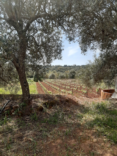
Neat vineyard near the start
Cross the ditch and turn left into a lane. Follow this for just over 1k to reach a main road (the N124). (After heavy rain, you may have to paddle or wade through one or two streams along this lane ). Turn left at the road and after c100m, turn right into a narrow lane leading to a group of houses. (4). Follow the lane as it turns sharp right at the end of the houses, and then shortly sharp left to head north. 350m further on, come to another tarmac road and turn left. After 100m, turn right into a narrow lane between buildings (one is an old cafe, now closed). (5) After c200m, the lane passes into open country and turns sharp right. Go straight ahead onto a rough footpath, which continues to head north, winding later and climbing over a low rise, to descend to a narrow tarmac road, around 650m from the last house.
Turn right and walk along the road for c500m, passing one group of houses up on the left. Come to a turning on the left, a dirt track with two access points, heading uphill. (6). Follow this, and at a fork after 150m, turn right as the track levels out. Soon turn right with the track as it descends past a couple of properties, then bends sharply left to come up to a T junction. Turn left and climb quite steeply to a cluster of houses, following the track round to the right through them. The track turns to tarmac in the middle of the hamlet, and descends towards a large house on the left. Where the tarmac turns towards the house, go straight ahead on a rough track over a slight rise (7). Keep right at a fork, and work round the northern end of a small barragem (dam).
Coming down the far side of the barragem, past the dam wall take the first turn left, (8) a narrow track running towards another group of houses. Turn right on reaching tarmac once more, and follow the road as it loops south round the first of the houses, turns north and then sharply east round the next block. (Ignore a tarmac turn at the bottom of the loop). Leave the houses behind and follow the tarmac eastwards for around 670m, past a junction with a small barn on the corner, past an enclosure with lion gateposts and on to a cross roads, with a tarmac lane on the right and a dirt track up into the hills on the left (9). Continue straight ahead for another 450m, down into a valley at a junction with a wider tarmac road, and several houses.
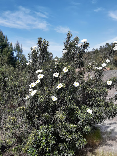
Gum cistus in flower (March/April)
Turn right and almost immediately left into a tarmac lane heading fairly steeply uphill. The tarmac runs out at the top, and turns into a dirt track through a clump of pine trees. Continue on this track for a further 330m, ignoring all turns left uphill, descending into a narrow valley and climbing to another small settlement. Stay left at a junction in the middle of the houses, and walk down to a junction over another 120m. (10). Turn left and walk up the hill between properties. The tarmac lane ends in front of a house. Bear right on a track going round the house and heading off into the hills.
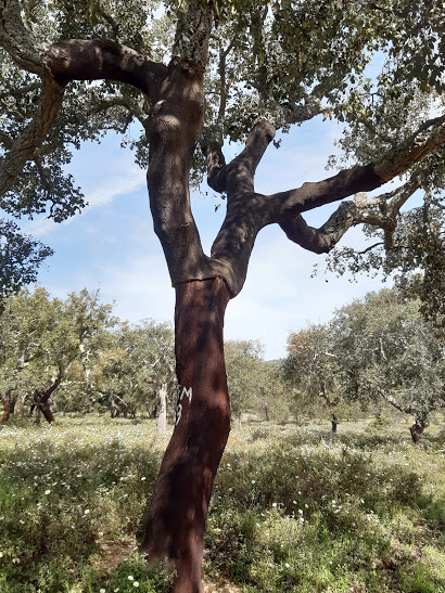 Newly stripped cork oak.
Take the first turn right off this track, due east, down into a dip and up the other side, and over a rise to join another track heading due south. Follow this down for 100m, to meet a tarmac surface in front of a house (11). Turn left here. The tarmac quickly runs out, and the track descends into a valley, then rises again, gently at first, then a little more steeply, to reach a saddle after around 560m. Here turn right and climb briefly to a ridge, with a small property over to the right. (12). Turn left and follow the ridge for 600m. Ignore any turns down to the right until the track you are on curves right at the end of this stretch and descends quite steeply over another 500m, to meet a track coming down on the left in a valley. Turn right here and walk a short distance down to a junction with a tarmac lane. (13).
Turn left and then right to follow this lane along to the main N124. Turn right and walk along for around 140m, where you will find a bar, if refreshment is what you need. Diagonally opposite the bar, to the left of a bank of postboxes, see a lane going uphill. Take this, and almost immediately turn right off it into a narrower lane. After 250m, come to a junction and bear right. Round a shallow bend, take the first turn on the left, (14) a field path heading almost due south. The path turns through 90 degrees after a short distance, and descends through a wooded area. Emerging onto level ground, pass two tracks turning left, but stay left at the third one. This heads southeast for around 140m before turning eastwards and running alongside a stream bed on the right. Pass through a wooded area, staying on the easterly course, and emerge to see buildings across on the right. Turn sharp right with the path and come out onto a tarmac road (15). See information anout Alagoas Park near the end of the path.
Turn right and walk along the road for 400m. Where the road curves up to the left, see an information board about the Via Algarviana on the right, and take the track on the right as indicated by the red and white waymarks. This stony track leads up to another tarmac road after just over 200m. (16). Turn right and walk up the road for 200m, then take the left fork uphill on tarmac. Follow this up to Palmeiros village. At the T junction turn right, and then take the track on the left running alongside the first house on the left. Follow this track, on level ground at first, then on a gently descending trend, for 1k. Arrive at a point (17), where a ´tongue´ of gravel leads into quite a faint track running southeast. (if you go round a curve and come to the end of the clear gravel track, you have gone too far.)
Follow this track as it becomes rather more clear and climbs up and over a long low hill. Starting to descend after 600m or so, the track winds down into a deep, narrow valley. Join a track in the valley and turn right. Walk alongside a field on the right with a lot of tracks and tall vegetation, and after 160m, swing right at a fork. See a ruin (and probably a caravan) over to the right, cross the stream bed (or wade after rain!) and turn up the hill on the left. After 280m, bear left at a junction, and come soon to a house on the left. 150m further up, come to a T junction at the end of a block of houses, and turn left. After c100m, fork right and follow the road for another 170m until it ends, with a farmhouse on the right and outbuildings on the left. (19) Find a faint path running by the topside of the outbuildings, and follow it as it crosses fields.
After 150m, the track crosses the ends of two tracks on the left and then turns sharply right uphill by a water tank on the left. Climb through 240m of narrow wooded pathway to reach a tarmac road and turn right. After a few metres, reach the main Loule/ Salir road at Mesquita. (If desperate for liquid, there is a small bar about 300m down the road on the left, but then you would have to retrace your steps) . To proceed, cross the road and climb into Mesquita, forking right at the first junction. Now follow the road through and out of the village, taking a right at a fork, 300m from the main road. (20).
Follow as the road descends, passes two large properties and then rises steeply, turning into a footpath at the end of the wall of the second one. After another 100m, bear left across open land and continue to climb, a little less steeply. As the gradient eases, see a large mast ahead, and pass it on the left. Pick up a track after the mast, through a broken wall, and follow this downhill for just over 1k, to reach a narrow tarmac road. . Turn right and walk for around 150m to a wider road and turn left. (21). Take the road on the right after a few metres, and walk up to the hamlet of Covoes. (800m). Pass the first block of buildings on level ground, curve left with the road and start to climb. Take a track on the right opposite a waste bin (22) and follow it downhill. After 300m, by a well, the track becomes surfaced. Follow it down to a main road at the bottom, and turn right to go to the cafe or left to return to your transport on the bridge.
GPS Points. (37/8)
| 1 | Turn left | 13 | 52 | 99 | 02 | 30 | 74 | 270m from cafe | ||
| 2 | Straight at X roads | 14 | 14 | 21 | 03 | 29 | 88 | 1.77k | ||
| 3 | Turn left into lane | 14 | 12 | 57 | 03 | 36 | 14 | 480m | ||
| 4 | Turn right off road | 14 | 30 | 75 | 04 | 07 | 92 | 1.17k | ||
| 5 | Turn right | 14 | 44 | 94 | 04 | 04 | 69 | 580m | ||
| 6 | Turn left off road | 15 | 02 | 36 | 03 | 47 | 03 | 1.27k | ||
| 7 | Straight across | 15 | 10 | 47 | 03 | 30 | 77 | 710m | ||
| 8 | Turn left after dam | 15 | 08 | 98 | 03 | 21 | 82 | 320m | ||
| 9 | Straight at X tracks | 15 | 07 | 80 | 03 | 03 | 55 | 980m | ||
| 10 | Turn left uphill | 14 | 58 | 66 | 02 | 30 | 17 | 1.1k | ||
| 11 | Turn lwft in valley | 14 | 53 | 94 | 02 | 06 | 21 | 380m | ||
| 12 | Turn left on ridge | 14 | 53 | 77 | 01 | 53 | 73 | 660m | ||
| 13 | Turn left on taarmac | 14 | 31 | 12 | 01 | 16 | 24 | 1.22k | ||
| 14 | Turn left on track | 13 | 23 | 94 | 01 | 30 | 46 | 660m | ||
| 15 | Turb right on road | 14 | 11 | 65 | 01 | 02 | 73 | 910m | ||
| 16 | Turn right on track | 13 | 53 | 65 | 01 | 10 | 23 | 610m | ||
| 17 | Turn left | 13 | 20 | 69 | 01 | 37 | 64 | 1.37k | ||
| 18 | Turn left | 12 | 54 | 02 | 01 | 37 | 16 | 1.45k | ||
| 19 | Turn left on track | 12 | 40 | 91 | 01 | 45 | 65 | 500m | ||
| 20 | Fork right | 12 | 34 | 26 | 01 | 53 | 21 | 840m | ||
| 21 | Turn left at road | 13 | 19 | 34 | 02 | 17 | 70 | 1.66k | ||
| 22 | Turn right | 13 | 39 | 89 | 02 | 45 | 36 | 850m to car park. | ||