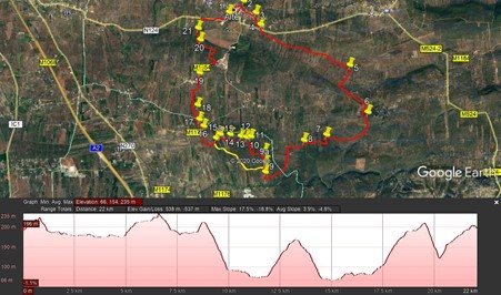
Walk Nineteen. Alte – Espargal Circular. 22.7kilometres Ascent: 560m.
GPS: 37/14 00 90 8/ 10 44 06
NOTE: This route has been edited. 5th December 2020.
A recent walk of this route found that the track between points 9 and 15 has become much more overgrown and difficult to navigate. I have therefore found an alternative, marked in yellow on the photo, bounded by points 9a and 15a. This is a more straightforward and lower-lying track, which reduces the total distance by around half a kilometre, and the total ascent by a small amount. I have left the original instructions between 9 and 15 in the text for anyone who wishes to try to follow them, but the new route is highlighted in red, with the old route in italics. You are advised to follow this new route.
This walk takes you from one of the prettiest small towns in the Algarve, across a broad valley and over open and empty moorland, down onto the plain again and back via increasingly cultivated land with sight of two small village communities and a new large-scale agricultural enterprise. There is a bar in Alte at the start, but no further refreshments until Monte Brito, an hour from the end.
Getting to Alte.
From the south, take the A2 motorway or the IC1 north to São Bartolomeu de Messines. From there, follow the N124, signed to Alte and Salir. Alte is about 8k from the motorway junction. At Alte, take the first exit from the roundabout, and park on the right. The bar for coffee at start and finish is just up the road on the right (Bar Folclore). Coming from the west, use the N124 all the way from Silves if you prefer not to use the motorway. From the east, use the M525 from Loule to Tor, turning left at the traffic lights and following the M524 to Ribeira de Algibre, turning right at the T junction to follow the road to Benafim, bearing left through Benafim to reach the N124 to Alte.
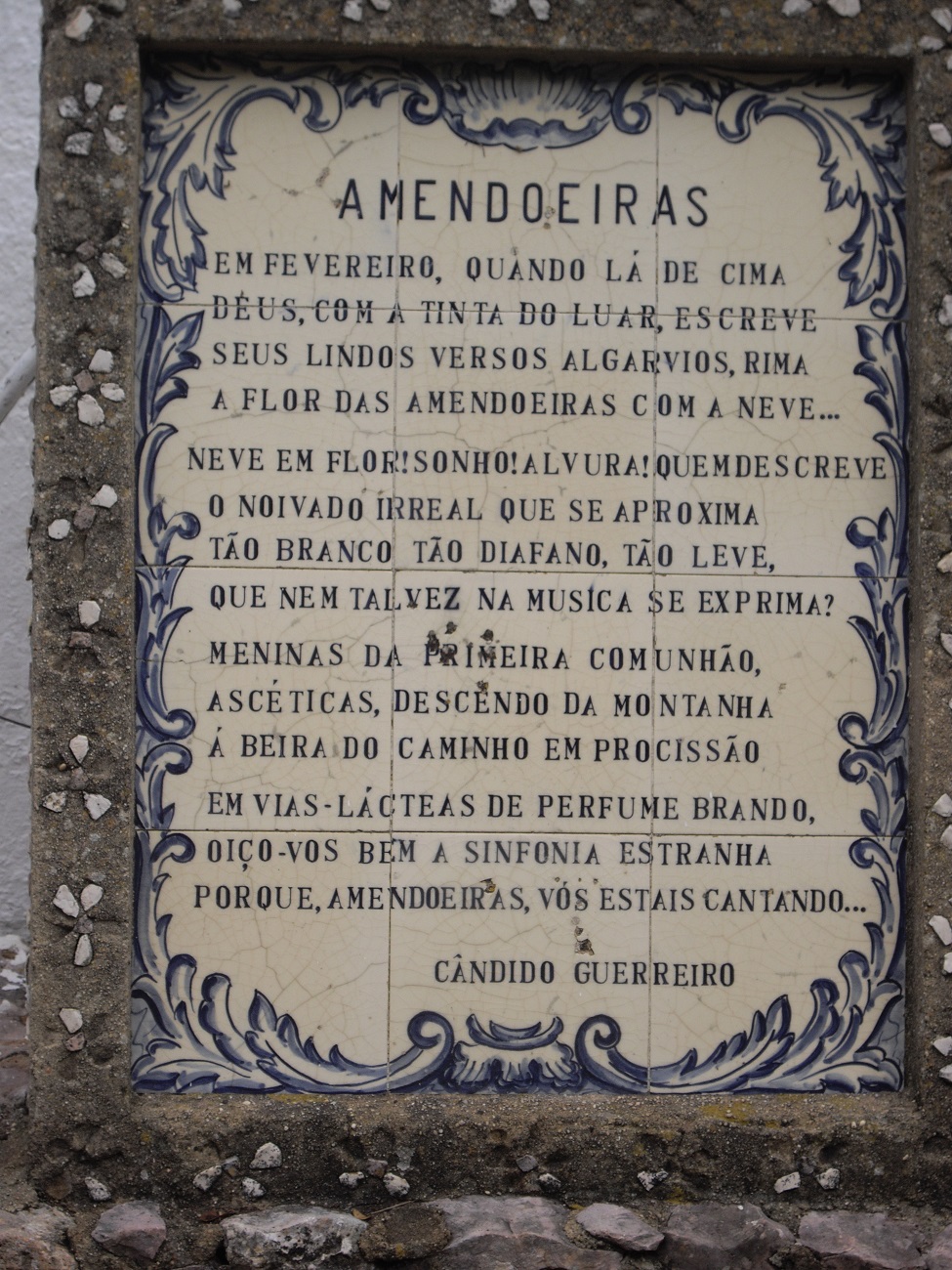
Poem by famous local poet Candido Guerreiro.
An ode to the almond tree
The Walk.
- With your back to the café, (1) turn right and walk up the main street of Alte. (300m) Walk up to the right of the church and then turn right and continue for around 340m down a long narrow street past the Farmácia (Chemist). Pass a small shop selling hand-made soaps on the left and a small bar , and find a turn to the right leading across a stream on a narrow bridge.(2) Cross over and turn right, walking past a car park and turning immediately left uphill. Walk past two turns to the right, and take the third one, leading downhill towards a large building on the right, which is a community centre (Centro do Dia). (3) (700m from the bridge)
- Walk past the centre on the road, and where it bends to the right go straight ahead onto a track uphill, heading in a south-westerly direction. Ignore a track to the right after a few metres and go ahead, past a small building, to the end of a walled area. Now do NOT go along the obvious double track beside the wall, but take a very narrow path heading a bit more southerly through low scrub and the occasional bush, down to a main road with a wide track leading off to the left, a short distance down the hill. (430m) (4) (There is a petrol station a little further down). Cross to this track, which you can reach by walking over the rough land immediately ahead. Now follows a long trek down this wide track, which is a public road, so there will be the occasional vehicle. After around 3.25k, come to the tiny settlement of Charneca (boundary sign half hidden behind a bush). A large building on the left is a sausage factory. (5) (If open, you can buy their produce).
- After passing this small group of buildings, come to a junction and bear right. (JC) At the next turn, go straight on, leaving the main track for a narrower and less evenly surfaced lane. (200m from the sausage factory) (NG) At the next junction (480m) turn left and start to rise gently. (HSA 8) Coming to a tarmac surface running across your line, go straight over on a short narrow path to join another wider track and turn left. (470m) (The narrow path cuts off a corner). Walk along this new track as it soon bends right and then is straight for some distance, on level ground. Ignore a turn to the right between walls halfway along and at the next junction (polytunnel skeletons) turn right (590m) and follow this line through an orange grove to yet another T junction, turning left here onto tarmac and rising to a tarmac road. Turn right along this road, the Caminho da Ribeira. (6) (550m)
- The road is descending at this point. Ignore the first turn to the right, leading to an enclosure and building, and take the second one, a dirt track which contours the hill. (570m) The trend is very gently uphill over some distance, walking past two large electricity pylons before the track bends to the left ahead of a third one (1.4k) (RC) (7) and climbs quite steeply again, curving back to the right, cresting the rise and beginning to descend slightly, passing a large water tank and containers on the right. (430m) After this the descent gets steadily steeper, crossing scrub and going through an orange grove. Go straight down at a cross-tracks, and soon after, (8) (620m) come to a track junction, with a much fainter track going off left. Take this one and continue to descend, passing to the left of another cultivated grove before joining a more obvious track coming down from the right and descending finally to a road running along the valley floor. Turn left here. (550m)
- Walk along the valley for around 1.44k, (the road becomes a dirt track) and take a track on the right which runs to the right of the ruins of some old polytunnels. (there may not be much left of these 2020).(9) Walk past the polytunnel site and after 360m, take a track on the left, before the one you are on begins to climb (9a). Now simply follow this track as it curves round the base of high ground to your right, for 2k, ignoring a couple of turns to the left in the early part, and one uphill to the right towards the end..Arrive at a junction with a track coming down from the right (15a) (you can probably see a house on the hill to the right), and turn left. Pass a small building on the right and turn right,
.Ignore turns to the polytunnels, and continue to walk due north as the track runs first on level ground and then begins to climb. Come to a junction with a short path between walls running due west, (770m) (10) and walk along it, turning right at the end to continue climb quite steeply. The path runs west again before returning to northerly. Arrive at a junction with an open area on the left, with two structures like gateposts near the opening. (940m) (11) Turn here and see on the left a whiteish circular mound, and walk over to it. This is one of a large number of old lime burning pits that people used to make the raw material for the whitewash they used to paint their houses, locally called cal. There are three of these on this hillside, and you must pass each one, but navigation is not easy.
- From the first pit, the route lies due west, along a narrow twisting path through scrub and bushes. Walk a little southwest of the pit, then turn west along the path. It turns northwest to circle round the second pit, so you should see it on the left after about 140 metres, rather more ruined than the first. (12). From here walk northwest for around 80 metres, turning westerly for another 120 metres to find the third pit. (13) From here the path runs slightly north of west for around 350 metres as the terrain gives way to rather more open ground with trees rather than bushes and scrub. A wider and more obvious, very uneven path begins to descend through trees from here (14). It emerges from the trees and continues downhill. Coming to a junction with a path from the left, turn right and very soon left again to walk down to a large villa (Casa Branca do Monte). (15) (340m from 14)- Walk down from the villa and take the right hand at a fork on level ground, turning right again at the first turning by a small white building,
and right once more at the end of a long straight to follow an even longer straight track to a junction with a tarmac road near the small settlement of Lentiscais. (1k) (16) Cross straight over the road and go down a narrow lane. Ignore various tracks on the left until reaching a turn on the left with a row of buildings on the right. Turn and pass these buildings. At the end of the range, walk round to the right and see another house facing you. (310m) Do not go right up to this, but take a track on the right (17) through a gap in the trees and up over a rise onto open land. When well clear of the house bear left across the open meadow to reach the line of a broken-down wall heading just west of north. Come to a point where there is a fairly narrow field facing you with lines of recently planted trees in two lines, with a path between. Follow this path until it turns left out of the field into a lane heading just north of west between walls. (520m) (18). Walk along to the first junction and turn right along a much better track.
- This runs straight for some distance, then turns right and wriggles to the left. At a junction go right and immediately left to emerge on a tarmac road on the outskirts of the village of Monte Brito. (1.3k from 18) (19) If you need refreshment, there are two bars in this village, only a short distance on the left. To continue, turn right along and up the road. Follow it until the gradient eases and you see the first signs of a large plant nursery over the wall on the right. Now look for a track leading off left and follow it through the scrub. (880m) Starting off north-westerly, the track then bends to northeast before returning to northwest after some distance. Follow as it runs along level ground. Around 1200 metres after leaving the tarmac, turn right on a very clear gravel track. (20) This crosses level ground and then begins to descend in a zig-zag pattern. Where the gravel covering ends, turn right and then zigzag down (this is an old terrace line) but keep to the narrow cleared pathway, which leads close to another old lime pit, and then goes through onto a wide track leading downhill alongside an orange grove.(21) (550m)
- Cross the stream at the bottom of the hill and walk up beside the grove. (It used to be possible to walk along the valley, but access is now closed off.) At the top, see a short concrete tunnel straight ahead, going underneath a road. ((540m) Go through the tunnel and climb out on the left hand side to scramble up a short bank onto the road. Turn left and walk to a roundabout, taking the first left off it which leads you back to the car park and the bar
Orientation normal. GPS Points. 37/8
| 1 |
Bar Folclore Alte |
14 |
02 |
07 |
|
10 |
42 |
91 |
|
|
| 2 |
Bridge |
14 |
13 |
43 |
|
10 |
23 |
18 |
|
670m |
| 3 |
Community Centre |
14 |
00 |
16 |
|
10 |
08 |
05 |
|
570m |
| 4 |
Main Road |
13 |
47 |
67 |
|
10 |
02 |
72 |
|
570m |
| 5 |
Sausage factory |
13 |
00 |
88 |
|
08 |
10 |
11 |
|
3.25k |
| 6 |
Nr Espargal |
12 |
10 |
58 |
|
07 |
50 |
24 |
|
2.19k |
| 7 |
Nr pylon |
11 |
49 |
53 |
|
08 |
45 |
03 |
|
1.98k |
| 8 |
Halfway down hill |
11 |
44 |
84 |
|
09 |
14 |
49 |
|
910m |
| 9 |
Polytunnels |
11 |
13 |
80 |
|
10 |
07 |
23 |
|
2k |
| 9a |
Turn left |
11 |
22 |
74 |
|
10 |
06 |
05 |
|
360m |
| 15a |
Turn left |
11 |
52 |
16 |
|
11 |
09 |
18 |
|
2k |
| 10 |
Turn between walls |
11 |
36 |
15 |
|
10 |
06 |
33 |
|
770m |
| 11 |
First lime burner |
11 |
52 |
04 |
|
10 |
23 |
60 |
|
940m |
| 12 |
Second lime burner |
11 |
51 |
48 |
|
10 |
29 |
25 |
|
140m |
| 13 |
Third lime burner |
11 |
52 |
86 |
|
10 |
36 |
45 |
|
200m |
| 14 |
Start of clear path |
11 |
55 |
46 |
|
10 |
50 |
40 |
|
370m |
| 15 |
Villa |
11 |
56 |
10 |
|
11 |
03 |
57 |
|
360m |
| 16 |
Lentiscais |
12 |
05 |
42 |
|
11 |
24 |
72 |
|
1k |
| 17 |
By house |
12 |
12 |
85 |
|
11 |
29 |
89 |
|
310m |
| 18 |
Wall corner |
12 |
27 |
97 |
|
11 |
30 |
94 |
|
500m |
| 19 |
Monte Brito |
13 |
01 |
22 |
|
11 |
25 |
72 |
|
1.3k |
| 20 |
Turn to orange grove |
13 |
35 |
47 |
|
11 |
22 |
18 |
|
2.1k |
| 21 |
At orange grove |
13 |
48 |
23 |
|
11 |
24 |
26 |
|
510m |
| 22 |
End |
|
|
|
|
|
|
|
|
1.45k |