Walk Twenty Eight. Bordeira - Monte Novo Circular. 19.6 kilometres. Ascent: 620 metres.
GPS: (37/8) 11.46.08 51.39.29
Bordeira is a village near the west coast, set on the side of a hill just off the main road from Aljezur to Vila de Bispo. The walk starts from here and first of all climbs quite steeply to the plateau to the north. It then loops south again and into a valley before climbing a second time up to the scattered settlement of Monte Novo. The return leg is the most exciting, with views of the sea as you descend back towards Bordeira. There is a small cafe in the village, but no other refreshments on the route. Navigation is very easy on this route, using only clear tracks the whole way. This route was first walked by Ingrid Bonte, who led the AWW over it.
Getting to Bordeira.
From east and south, take the A22 motorway to where it ends, just outside Bensafrim. At the roundabout turn north for Aljezur,(N120) and follow the road along the valley and then up a winding climb. At the top, near wind turbines, turn left, signed to Monte Ruivo and Alfambras. Follow this road to a T junction and turn left, signed for Sagres (brown sign). The road runs level for a distance, then descends a long and winding hill. Continue to and along the valley. Bordeira is on the left hand side. Park on the right as soon as you turn off, and walk into the village, as parking is difficult in there.
The Walk
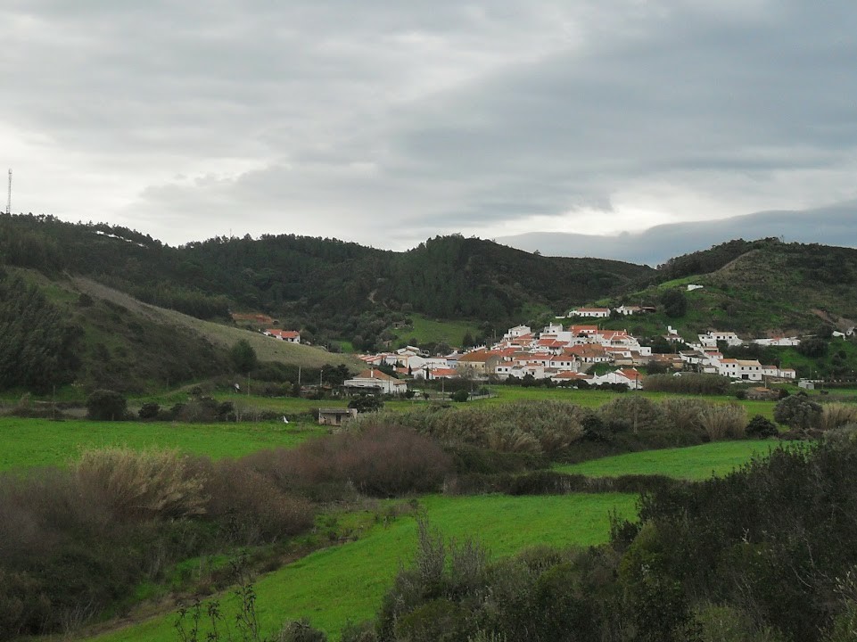
Bordeira from the main road. Photo credit: Angel Alfageme Loeches.
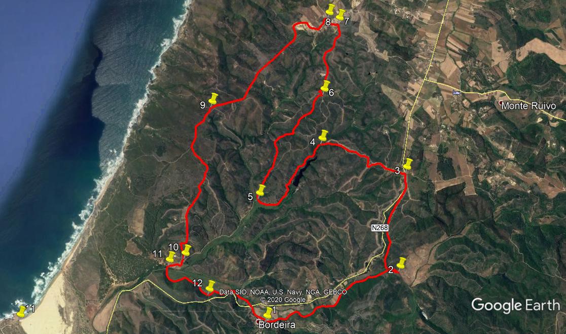
With your back to the cafe, (1) walk straight ahead into the Rua da Escola, and follow it as it goes out into open country. The track runs roughly parallel with the main road you came in on, and for 2.3k it follows an undulating course. It then veers away from the road for a short distance, hairpins back towards it (2) and then rises quite steeply to the plateau. Shortly after reaching level ground, the track turns to join the main road. Walk along the road for 170m, to see a ruin on the right. Turn left (3) onto a wide track that runs due west and then northwest for around 1.8k, descending over the whole distance.
Reach a point where a long barragem comes into view to the left, (4) and follow the track round to run to the right of it, continuing to descend. Reach a valley floor and follow the track as it curves round to the right. Just past the apex of the curve,, a track leaves on the right, heading southwest.(5) Ignore this, and turn to walk northeast with the track you are on.You are now climbing steadily. Continue for the next 2.16 k, ignoring two obvious turns to the left. At the next clear junction, a five-way affair, take the second on the left (6), walk a short distance and turn right at the next junction. Continue to climb for the next 1.33k, passing a large house on the left, and emerge on level ground at a tarmac road (7) This is Monte Novo.
Turn left along the road and take the second on the left, signed to Malhada da Cerva.(8). Stay on the road as it winds through the settlement and out into open country. The road becomes a track, and eventually the sea comes into view on the right. After 2.7k, come to the first of a small number of tracks leading down to the sea.(9) The detour to the cliffs is around 2k there and back. Otherwise continue on the main track for another 2.8k, descending very slowly, then more steeply over the last 260m, to arrive at a farm building on the right.(10). Pass the farm and swing round to the right to cross an open field. Arrive at a cross-tracks with bushes (11), turn left and proceed to walk around the edge of a large flat open space on the left, with bushes on the right. After 960m, ignore a turn to the right that would take you onto tarmac (12), and continue round the edge of the flat land. After a further 840m, come to a tarmac road, cross it and walk back to your car, or to the cafe in Bordeira (or both).
GPS Points
| 1 | Bordeira | 11 | 46 | 08 | 51 | 39 | 29 | |||
| 2 | Hairpin Left | 12 | 08 | 51 | 50 | 11 | 70 | 2.47k | ||
| 3 | Turn Left | 13 | 00 | 21 | 50 | 05 | 14 | 1.78k | ||
| 4 | Sight of barragem | 13 | 15 | 91 | 50 | 57 | 60 | 1.56k | ||
| 5 | Stay right | 12 | 49 | 11 | 51 | 40 | 35 | 1.62k | ||
| 6 | Turn left | 13 | 41 | 33 | 50 | 55 | 22 | 2.16k | ||
| 7 | Turn left | 14 | 17 | 55 | 50 | 43 | 39 | 1.33k | ||
| 8 | Turn left | 14 | 20 | 54 | 50 | 49 | 77 | 220m | ||
| 9 | Stay left | 13 | 36 | 99 | 52 | 08 | 16 | 2.7k | ||
| 10 | Turn right | 12 | 20 | 14 | 52 | 30 | 13 | 2.78k | ||
| 11 | Stay left | 12 | 16 | 98 | 52 | 40 | 68 | 330m | ||
| 12 | Stay left | 12 | 01 | 44 | 52 | 15 | 75 | 960m | ||
| End | 1.2k |