Walk Fifty Three. Pedralva - Praia de Muracao Circular. 18 kilometres. Ascent:
GPS: (37/8) 08.26.58 51.44.62
The section of the west coast from Carrapateira down to Cabo de Sao Vicente (Cape St. Vincent) is less accessible than other areas, but the rewards when you get there are great. Wild open moorland, pleasant hidden valleys and spectacular cliffs and bays are the chief attractions. This walk gives you a flavour of all three, starting from a small holiday village out in the country, over the hills to the sea, visiting one of the many small beaches along the west coast, and returning on a different route. The terrain is not too difficult, and the navigation very easy compared with some other routes in this series.There is a cafe/restaurant in Pedralva, rather expensive but there is no other choice. No other refreshments on the route.
Getting to Pedralva.
The west coast in general is not too easy to access along this part, but the roads are generally quiet and if distance does not put you off, the rewards are great. The most straightforward route is to go along the N125 out to Vila do Bispo (use the A22 to Lagos and then the 125). Take the first exit, and follow signs to Aljezur (N268). The turn to Pedralva is about 7.5 kilometres along, on the right. Best place to park is down by the restaurant.
The Walk.
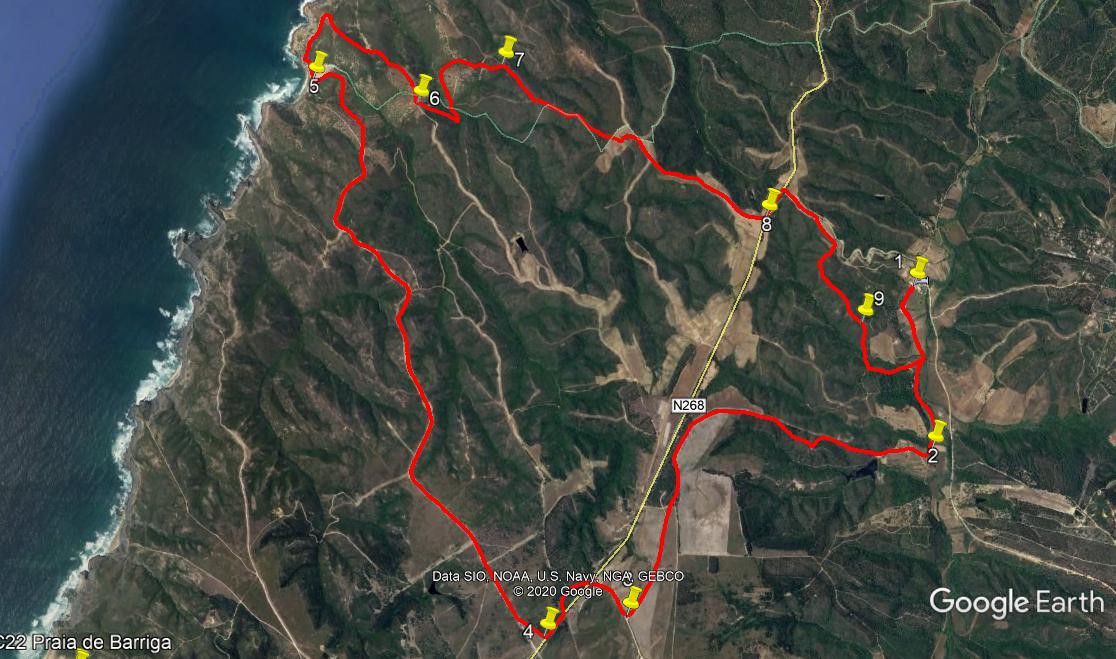
- From the corner of the restaurant, (1) take the road running southwest, which soon turns from a solid surface to a dirt track. Follow this for just over 1.2k, to reach a fork.(2) Take the right hand track, which leads quite steeply uphill, passing a ruin on the right and then a largish dam or barragem on the left. The track climbs just north of west for 1.5k, with the gradient gradually easing. There is a small diversion from the straight line about halfway up, but simply follow the path. The track then swings through a wide arc to the left, reaches level ground and then runs just west of south for another 1.6k. Come to a junction and go through a hairpin turn to the right, (3) pass between two wind turbines, cross a main road and follow the track round through a semicircle to end up on a track running alongside the road, heading southwest.
- Continue for just over 200m, then turn right (4) on a narrow gravel road, heading roughly nothwest. Stay right at a fork after 1.46k and again after another 1.94k. After almost 2k from the start, the surface deteriorates more to a sand track. Follow its winding course for another 2.8k, finally descending to the sea at Praia de Muracao. (5). Turn right on the sand, and find your way up the rocky mini-cliff at the northern end. There are two alternatives. The agile can climb up in one of two inlets quite close to the sea. The more sedate should walk inland a little to find a slightly easier way up, leading to a narrow path taking you back seawards. In either case, join the wide track leading up to a lone house about 400m away. Before reaching the house, take a track on the right leading away from the coast. This soon joins another track coming in from the far side of the house, and heads away southeastwards. Follow this line for around 940m, involving a sharp little ascent at one point.
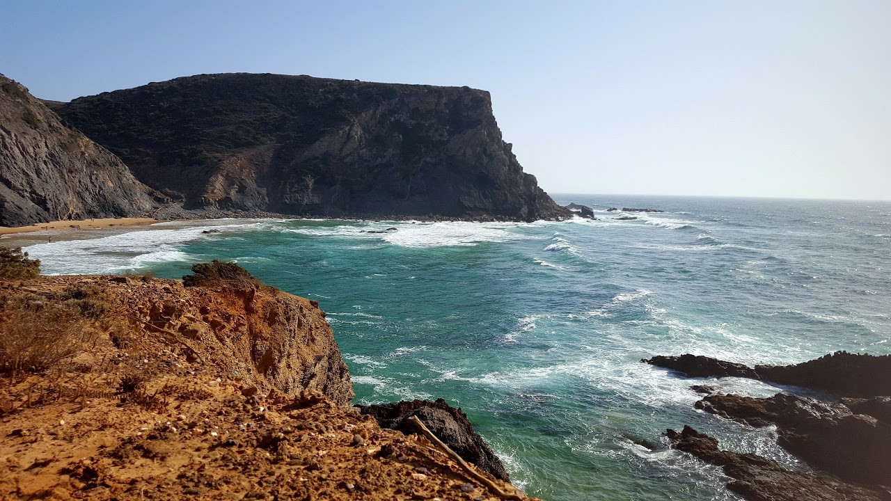
Praia de Muracao. Photo credit: Telmo Gomes.
- Soon after topping this climb, find a narrower track heading off downhill on the left,(6) and follow it as it descends quite steeply. After 290m, the track bends sharply to the left and continues to descend. At a fork, take the left hand choice and start to climb again, swinging round in a wide arc to the right and continuing to climb to reach a T junction. (7) Turn right and follow this new track southeast for just over 1k. At this point pass ruins left and right, then a two-pronged track junction on the left. 160m on from the junction stay left at a fork, then walk a further 960m with a tree plantation on the left, to arrive at a main road (8). Turn left and then first right. This is the road you drove in on, so if you wish you can walk back to the start on it. If you want to avoid the road, turn off to the right on a track after 300m, and follow this as it descends slowly towards the valley, with Pedralva below. Stay right at a fork after 900m, (9) and a further 320m along turn left to descend past a house down to a junction. This is the track you started on, so turn left to walk back into Pedralva.
GPS Points.
| 1 | Pedralva | 08 | 26 | 58 | 51 | 44 | 62 | |||
| 2 | Fork right | 07 | 50 | 26 | 51 | 41 | 54 | 1.2k | ||
| 3 | Hairpin right | 07 | 15 | 71 | 53 | 08 | 00 | 3.25k | ||
| 4 | Turn off main rd | 07 | 12 | 24 | 53 | 30 | 58 | 850m | ||
| 5 | Praia de Muracao | 09 | 17 | 16 | 54 | 31 | 92 | 4.84k | ||
| 6 | Fork left | 09 | 10 | 44 | 54 | 02 | 07 | 1.47k | ||
| 7 | Turn right | 09 | 18 | 38 | 53 | 37 | 87 | 1.15k | ||
| 8 | Left at main rd | 08 | 42 | 25 | 52 | 26 | 18 | 2.22k | ||
| 9 | Fork right | 08 | 39 | 79 | 52 | 19 | 92 | 1.42k | ||
| End | 1.27k |