Walk Thirty Five East of Mahao - the Easier Side. 17.6k Ascent: 600metres.
GPS: 37/ 18`05.17 8/ 06` 04.17. (Café Miramar)
This walk takes in a wide sweep of open country north and east of the high level village of Malhao. (See also the other walk from here, Malhao Circular, which is more challenging). Although it involves a fair amount of climb, the slopes are not severe, but the views amply reward the limited effort involved. There is a cafe at the start/finish, but no other refreshments. This walk was devised and led by Frank McEwan, for the AWW.
Getting to Malhao.
From the A22 motorway or the N125, take the IC1 road north to Sao Bartolomeu de Messines. Turn east along the N124, signed to Alte and Salir. Stay on the road through Alte. Benafim is the next main settlement along the road. At the eastern end of the village, turn left at the roundabout and follow all signs to the small settlement of Sobradinho, just over 6k away. At Sobradinho, turn right towards Cortinhola on the M542. Drive through this scattered settlement and stay left at a main junction, now signed to Malhao (brown sign). Follow signs to Malhao, passing Pe de Coelho and climbing a steep, winding road. As the road levels out at the top, see the Café Miramar ahead on the right hand side of the road. Park here.
The Walk
Malhao East Walk description.
With your back to the café,(1) turn left and left again to descend the main tarmac road, for 470m. Now take the fork on the left and descend for a further 200m, arriving at another fork (2). Bear right here and continue to descend slowly for a further 280m. Now stay left and continue on more or less level ground for a further 860m. (3). Stay on this main track for just over 1k, fairly level at first, but climbing slowly over the second half. Arrive at a sharp left hand turn (4) and stay on this main track for another 660m, seeing a settlement (mostly ruins) come into view on the left at (5). On the next stretch, of 370m, pass more ruined buildings on both sides, to arrive at (6), where the track is turning right, to face more or less northeast.
Over the next 830m, the track first of all stays fairly level, but then rises somewhat, to descend again to (7). Here the track turns sharp right, and remains more or less level, broadly easterly, for another 400m. Now at a fork with a lesser track, turn right onto it, facing due east. (8). Walk forward for 130m, uphill, when the track curves to the northwest. 100m further on come to a track junction and turn very sharp right, walking now southeastwards for a further 140m to a cross tracks. (9). Go straight across here and round a very shallow curve for another 140m. Now turn 90 degrees left on a fairly wide track with trees on the left. After 100m, fork right, due east, on a narrower track heading down into a valley.
Arrive at a wider track on the valley floor and turn right along it. (10). Descend steadily for 830m, passing a small barragem on the left, to join a track coming in from the right (11). Bear left to follow the main valley track for another 420m to a junction of tracks, with a tarmac road a short distance away ahead (12). Now turn through a hairpin left, and start to climb steadily, facing northwest. After 140 metres, the track turns to the northeast and continues to climb. After 580m come up to the tarmac road. (13) Cross the road diagonally and take the clear wide track on the right. This leads along a long ridge for 1.53k, always tending southeast. At the end of this distance, the track descends more quickly and describes a fairly tight turn to the left.
About 110m after the track straightens out again, still descending, find a narrow track on the right, running off more or less parallel with the main track. (14). Take this track, which turns right after around 110m. It then runs southeast and then due south and finally southwest over the next 730m. Arriving at a valley floor, turn right (15), and follow the track as it begins to climb. After 170m, turn left and continue to climb over the following 260m. At a junction with a track on the right (16), go straight on along a ridge for the next 550m, rising quite quickly due south over the last few metres. From here (17), take the right fork and continue along the ridge for another 900m, again rising a little in the final metres of the section. Fork right once more (18) to stay on the ridge, maintaining the south – southeast direction, for another 560m.
Now start to descend from (19), for the next 850m, to reach a wide track in the valley (20), and turn right. After 500m, take the left hand track at a fork, and continue northwest for a time, climbing once more, before swinging round to southwest, and passing the small settlement of Cravais de Cima, sitting on a low ridge. (21). From here, descend a little, swinging right with the main track at a junction, and then following this for 670m to reach a tarmac road (22). Turn left and walk up the road for 330m, then take a track on the right leading off at an acute angle. Follow this due north and then due west for 290m, to a T junction with another track. (23).
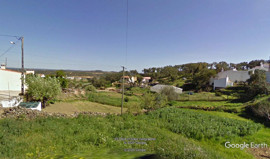
View from Mlahao village, near the end of the walk.
Turn left here and walk for 280m to reach a fork with a tarmac lane coming in from the right. You are now back at Point (2). Turn sharp right at the fork and follow the road round and through the village of Malhao. Do not turn left halfway through the village, but continue round it for 650m before coming to a junction. (24). Bear left along the tarmac here to reach the café where you began, 260m along.
GPS Points 37/8
| 1 | Cafe Miramar | 18 | 09 | 88 | 05 | 45 | 10 | |||
| 2 | Right fork | 18 | 22 | 97 | 05 | 56 | 16 | 640m | ||
| 3 | Cross tracks | 18 | 52 | 38 | 05 | 35 | 95 | 1.12k | ||
| 4 | Turn West | 19 | 21 | 569 | 05 | 45 | 20 | 980m | ||
| 5 | Interim 1 | 19 | 31 | 70 | 06 | 06 | 28 | 660m | ||
| 6 | Interim 2 | 19 | 42 | 68 | 06 | 09 | 71 | 360m | ||
| 7 | Turn east | 20 | 03 | 20 | 05 | 52 | 50 | 800m | ||
| 8 | Fork right | 20 | 03 | 79 | 05 | 37 | 23 | 410m | ||
| 9 | Fork left | 20 | 02 | 03 | 05 | 25 | 38 | 350m | ||
| 10 | T junction | 20 | 02 | 77 | 05 | 12 | 55 | 370m | ||
| 11 | Left in valley | 19 | 42 | 02 | 04 | 53 | 99 | 830m | ||
| 12 | Hairpin uphill | 19 | 35 | 72 | 04 | 39 | 35 | 420m | ||
| 13 | Road xing | 19 | 56 | 46 | 04 | 32 | 00 | 780m | ||
| 14 | Right off main | 19 | 37 | 99 | 03 | 53 | 20 | 1.51k | ||
| 15 | Valley floor | 19 | 23 | 94 | 03 | 34 | 77 | 830m | ||
| 16 | Join main | 19 | 16 | 54 | 03 | 35 | 66 | 500m | ||
| 17 | Right fork | 19 | 00 | 82 | 03 | 38 | 28 | 540m, | ||
| 18 | Stay right | 18 | 37 | 71 | 03 | 52 | 33 | 880m | ||
| 19 | Fork right | 18 | 22 | 31 | 03 | 58 | 62 | 530m | ||
| 20 | Main track | 18 | 07 | 96 | 04 | 05 | 75 | 850m | ||
| 21 | Round village | 18 | 21 | 55 | 05 | 05 | 75 | 1.3k | ||
| 22 | Tarmac | 18 | 22 | 79 | 05 | 30 | 03 | 870m | ||
| 23 | T junction | 18 | 30 | 53 | 05 | 50 | 22 | 650m | ||
| 24 | On main road | 18 | 13 | 10 | 06 | 07 | 10 | 940m | ||
| End at cafe | 260m |