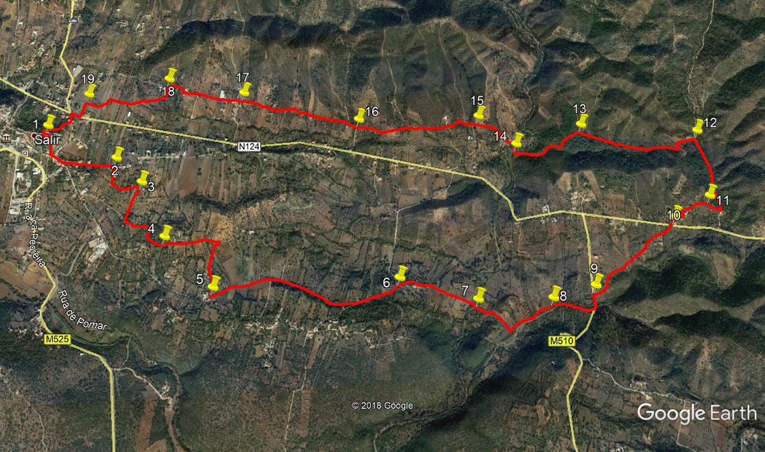
Walk Sixty Seven Salir – Touriz – Salir. 13k. Ascent. 360 metres.
This is a short walk with only a couple of arduous ascents. It can be completed in a morning, perhaps at the end of spring when temperatures are becoming uncomfortable in the afternoons. Starting from the church at Salir, it wanders through lowland country to the south and east of the town, returning via low ridge from the hamlet of Touriz, on the EN124. The walk ends with a further lowland section before the final brief ascent back to the church. The route shares some sections with parts of the Via Algarviana. There are no refreshments on the route, but it starts and ends at the tapas bar Janela da Serra, in the church square.
Getting to the start.
From the south, take the IC1 road from the A22 motorway or the N125 near Albufeira, and travel north to Messines. Follow signs to Alte and Salir, going east on the N124. Pass through Alte and Benafim on this road and arrive at a roundabout, signed right to Salir. Go up the winding road and take the first left into the main street. After the Farmacia (chemist), take a left turn. Go up and over the rise, turning right at the crossroads. Go down and then up this narrow street to the church square at the top. Coming from Silves, use the N124 to Messines and then follow from there.
From further east, you can take the M525 north from Loulé to Salir. Follow the main road round Salir, pass the (unopened) fire station and petrol station and take the first right. Turn right at the T junction and right again into the main street opposite the Farmacia (chemist). Then follow instructions above.
The Walk.
- With your back to the tapas bar, (1) walk diagonally left, past the corner of the church. Find a narrow entrance leading downhill via long series of broad steps, with a garden area on your left. Emerge at the bottom onto a narrow street, and turn left. Stay on the left hand side of the street, and when you come to a junction after a short time, bear left into the Rua Jose D Fonseca. Walk along here for 330 metres, to find a narrow entrance on your right, with a bench seat on the corner. (2) Turn into this. From here, you are on a section of the Via Algarviana, marked with red and white markers. If uncertain, follow these marks to Point 8.
Walk up the slight incline, and at the top after 120 metres, turn left and walk on more or less level ground for a further 190 metres, passing a single building on the left. Coming round a bend, see a ruin on the left. Immediately after this (3), turn sharp right off the main track onto a narrow footpath leading off south west. Follow this path as it turns more southerly and ends after just over 200 metres at another wider track by buildings.
- Turn left here to pass by some of the buildings, and see another narrow path over to the left. Walk down this for 170 metres. At a path junction with old stonework opposite, turn right and walk for a further 80 metres. Now find a footpath leading off downhill on the left. Take this as it crosses a small valley and climbs up to meet a tarmac road. (4) Climb this short steep slope for 100 metres. Where the road turns towards buildings, go straight across into another narrow footpath. Follow this for about 180 metres, and at a junction bear right, to emerge after a further 100 metres at another tarmac road.
- Turn sharp right into this road, and follow it for 350 metres as it first rises and then drops down towards houses. Just before the houses, turn left (5) onto a dirt track, which leads you on level ground for a further 400 metres to another tarmac road. Bear left into this and walk along it for around 850 metres, ignoring two tarmac turns on the right along the way. Descend a little, and come to a turn on the right signposted to Fonte Morena. (6) Turn here, and take the left fork downhill, avoiding the buildings to walk along the valley floor on a dirt track.
- After just over 500 metres, cross a stream bed (or paddle through it if wet) (7) and pick up the path on the opposite side. Continue for a further 150 metres until you see another stream ahead. Just before the stream, take a path on the left which follows the line of the stream as it curves round the base of the hill to the right. Ignore a fairly obvious track on the left heading north, halfway round this curve (8) After almost 600 metres, emerge onto another tarmac road. Here you stop following the Via Algarviana signs.
- Turn left up the road. Here you have a choice. You can walk up the tarmac to the N124, and turn right along it to walk to Touriz (Point 10), but this is tedious. The more interesting way is as follows – 100 metres along the tarmac, find twin paths leading off to the right. (9) Take the right hand one and follow it over a rise, heading broadly north east. Look across the valley from the crest, and see some cottages along your north easterly line. Now use the farm track across the valley ahead to make your way towards them. As you approach the cottages, you will come to a more obvious track, but this leads to a locked gate. Turn off the track left and make your way through light scrub, coming back to the track beyond the gate. (You will not get into any trouble). The track soon joins with the main dirt road from the cottages, which in turn leads out onto the N124 opposite a house. This is Touriz. (10)
- Cross the road and take the track to the left of the house. Bear right behind the first house and pass one more on the right and one on the left. Now turn off the main track through the hamlet, between houses, and circle right, round the trees at the back. Find an overgrown track heading northeast past a ruin on the right, level at first, then climbing to a low ridge with more ruins. Walk straight ahead between the walls at the crest and look down into the valley beyond. See a clear dirt track heading up the valley, and drop down to it. (11).
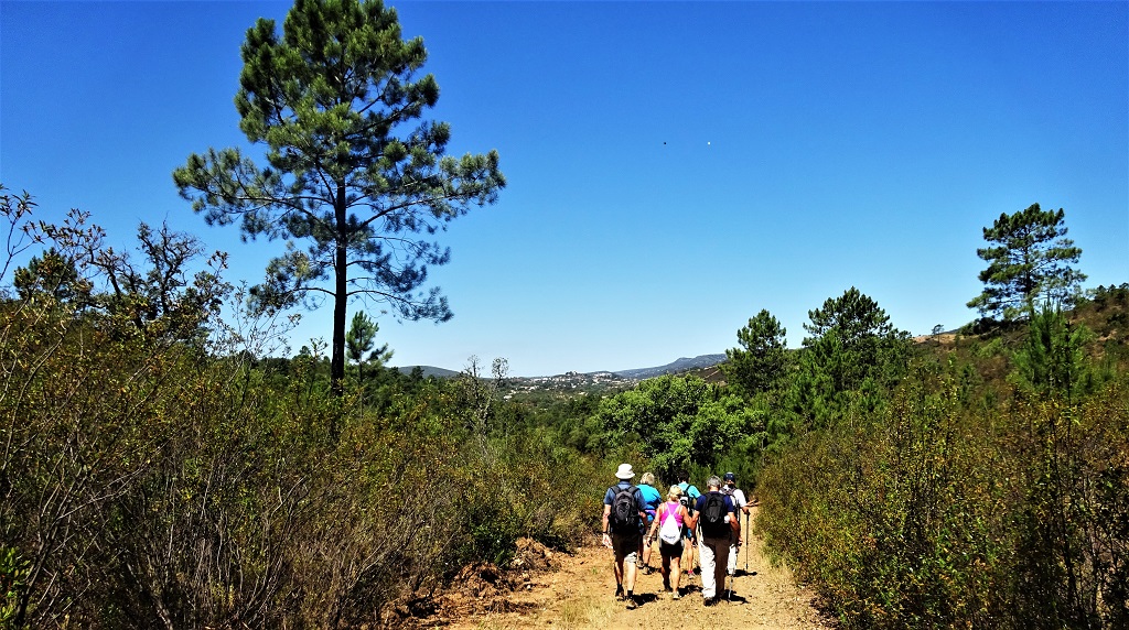
- Turn right along the track and walk down to the junction with a much wider dirt road after around 100 metres. Now turn sharp left into this road and walk up the valley for 500 metres. (12). Find a track on the left leading steeply uphill, and walk up it. After 130 metres turn left at a junction, and then bear right after another short distance. Now follow this track as it begins to descend gently over the next 700 metres through pine woodland. At the end of this section, a track comes down from the right to join your way. (13) This is the Via Algarviana route once more, coming down from Barranco do Velho on its way to Salir. Stay on the downward track for another 500 metres to reach an open area at the valley floor. (14)
On the way down through the pinewoods.
- Turn right here to walk a few metres to a stream (or dry bed), and cross it at an angle to walk up the track on the other side, noting an old building (a mill) on your left. At a fork beyond the mill, bear right, and at the next junction turn left. After another 100 metres take the second on the right to climb northwesterly to reach a point after 180 metres with the drive to a house on the right and ruins on the left. Go straight ahead here, broadly east, down into a small valley and up the other side, then repeat and emerge at a junction, with another modern house up to the right. Continue along the same line eastwards, now along a very clear dirt track, for a further 600 metres, reaching a narrow tarmac surface at a corner. (16)
- Carry on eastwards up the hill and follow this tarmac road for just over 800 metres to come to a small cluster of buildings, with quite a large house with a car port on the left. (17). This is Poço do Arneiro. At the corner beyond this house, go straight ahead up a short slope, and follow the way between the buildings. When the metalled surface turns a corner, go straight ahead on a slightly overgrown path behind a barn – like building and past a set of polytunnels. Now the path leads over a short stretch of open land, to end at a concrete road. Bear right along it, through a small settlement and on. Just before the next set of houses, up a slope, find a turn on the left, onto a grassy track leading downhill. (18)
- Follow this track as it wanders across a shallow valley, and after 640 metres, ends at a tarmac road.(19) Turn left here and walk up the short distance to the main road, the N124. Cross it and turn right to walk to a crossroads after a short distance. Turn left uphill, and after less than 100 metres, bear right up a steep narrow road. At the top, turn right again on a tarmac surface, and walk up to the church square and the tapas bar from which you started.
GPS Points. 37/ 8 and 7
| 1 |
Church square |
14 |
28 |
41 |
|
02 |
35 |
52 |
|
|
| 2 |
Turn by bench |
14 |
21 |
27 |
|
02 |
16 |
66 |
|
600m |
| 3 |
L turn to footpath |
14 |
16 |
07 |
|
02 |
09 |
50 |
|
310m |
| 4 |
First tarmac |
14 |
04 |
59 |
|
02 |
02 |
52 |
|
560m |
| 5 |
L turn before house |
13 |
54 |
29 |
|
01 |
49 |
54 |
|
740m |
| 6 |
Fonte Morena |
13 |
56 |
25 |
|
01 |
03 |
06 |
|
1.24k |
| 7 |
Stream crossing |
13 |
51 |
95 |
|
00 |
43 |
62 |
|
520m |
| 8 |
No Left turn |
13 |
51 |
56 |
|
00 |
29 |
32 |
|
580m |
| 9 |
Turn off road |
13 |
54 |
84 |
|
00 |
14 |
24 |
|
370m |
| 10 |
Touriz |
14 |
02 |
18 |
|
00 |
01 |
17 |
|
730m |
| 11 |
Touriz ruins |
14 |
13 |
30 |
|
59 |
43 |
19 |
|
320m |
| 12 |
Base of hill |
14 |
27 |
37 |
|
59 |
44 |
49 |
|
590m |
| 13 |
Track junction |
14 |
28 |
74 |
|
00 |
15 |
06 |
|
840m |
| 14 |
Open area |
14 |
34 |
29 |
|
00 |
41 |
46 |
|
500m |
| 15 |
First house w.drive |
14 |
30 |
62 |
|
00 |
41 |
91 |
|
350m |
| 16 |
Narrow tarmac |
14 |
29 |
82 |
|
01 |
13 |
58 |
|
810m |
| 17 |
Poco do Arneiro |
14 |
35 |
90 |
|
01 |
44 |
29 |
|
800m |
| 18 |
Turn off concrete |
14 |
39 |
01 |
|
02 |
04 |
44 |
|
530m |
| 19 |
Turn onto road |
14 |
35 |
47 |
|
02 |
25 |
60 |
|
640m |
| 20 |
End |
|
|
|
|
|
|
|
|
440m |