Walk Sixty Nine. Sao Barnabé. 16.6k Ascent: 780 metres.
GPS: 37/ 21 26 42 8/ 09 55 16
Sao Barnabe is a tiny community just over the border into the Alentejo, but within easy reach of the main centres of the Algarve for a day´s walking. The walk is through remote countryside, with some quite serious climbs and lots of water to cross if there has been rain. After very heavy rain, it is best avoided.
Getting to Sao Barnabe.
From the south and west. Use the 124 or the IC1 to get to Messines. Drive in the direction of the A2 and Salir to arrive at the roundabout before the motorway. Turn left here, and at the end of the long straight, facing a restaurant, turn right onto a road which is the M542. Follow signs to Cortinhola, along a winding but very attractive country road, passing numerous villages. Passing through Cortinhola come to a junction and turn left, signed to Almodovar and Malhao. Follow this road for around 12.5k to find a junction on a hilltop near a wind turbine, signed left to Sao Barnabe.The village is around 9k along this road. An alternative, better for those coming from Loulé and points east, is to take the M525 north from Loule to Salir, driving round Salir to reach the 124. Turn left at the 124 roundabout and then look for a sudden turn on the right, after a bend, signed to Malhao and Cortinhola, among other places. Follow signs to Malhao and pick up the western route outside Corinhola.
The Walk
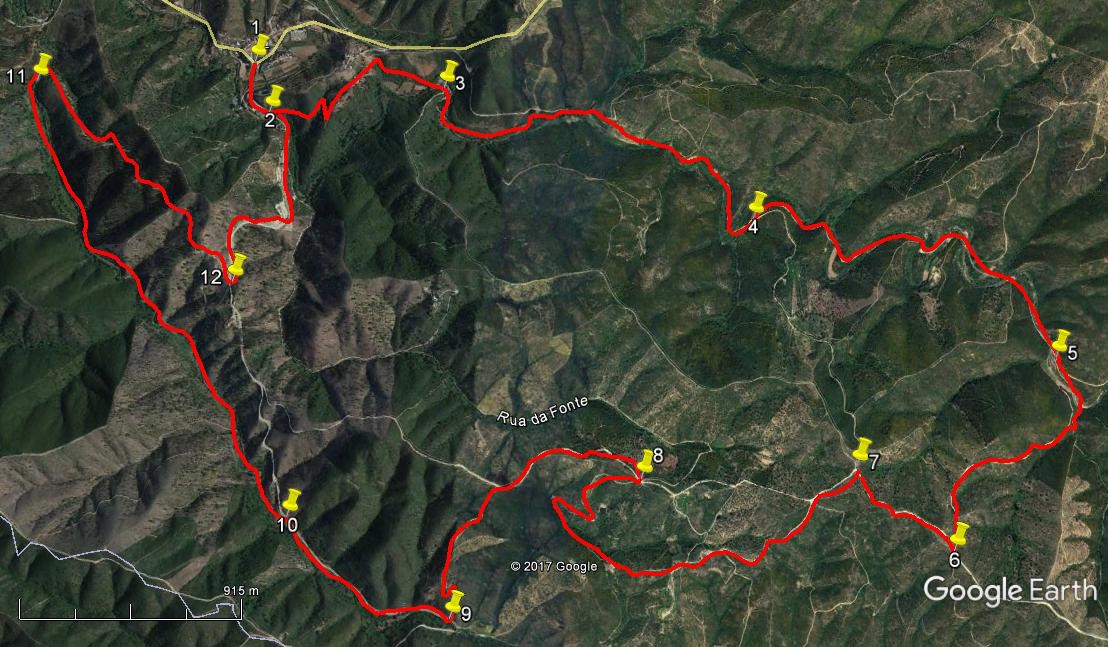
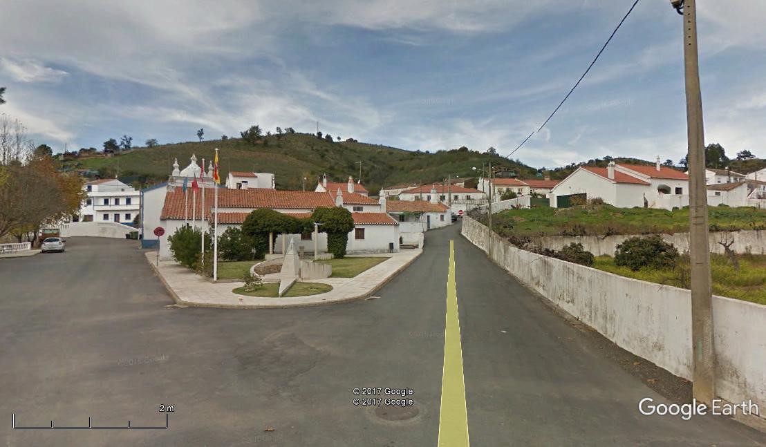
- Start from the fork in the road at the entrance to the village near the Junta de Freguesia - parking area up on the left. (1) Head down the road towards Zambujal (signed). Ignore the first turn to the left, which is at a cross-roads, and take the second one after 260m, (2) a dirt track heading uphill. Walk along here, 190m east, then turn east of north for 110m, swinging south-east for 120m, climbing all the time. Turn north-eastwards again towards a house, passing it on the left. Reach a high-point near the house and start to descend. At a fork take the right-hand to pass a house and reach a sharp right-hand bend after a further 360m. Now head south east, descending, for a short time before turning more easterly and reaching a turn to the right after going through a shallow valley with a stream and climbing out the other side (3) – a further 330m.
- At the crown of the bend, turn off to the left on a path that quickly crosses a stream and turns south. Follow for 130m and re-cross the stream, turning left to walk near it for 100m before crossing for the third time. Now follow this track, first slightly south of eat, then slightly north, ignoring an obvious turn right. After 400m, stay right at a fork near a house and walk a further 150m to reach a much wider track. Turn right and follow an undulating track east for 120m, then turning south-east for 190m (ignore a left soon after the turn). Cross water again twice in quick succession at the end of this stretch and turn slightly more southerly. The path tends ever more to the south and climbs gently, finally facing due south for a time, then swinging round quite sharply to north-east, and crossing water again before reaching a fork after a further 390m. (4)
- The next stage involves a further seven water crossings. Wind above the stream for 470m, then cross. Cross again after 200m, heading NE, then after another 270m, going briefly south. Cross again 170m on and again after another 100m, now SSE. 250m on, cross once more, ignoring a left uphill on this stretch, then finally after another 390 SSE, cross again arriving at a fork to the right less than 100m afterwards. (5). Take this fork, cross the stream yet again and then make a long climb over the next 1.3k, to reach a ridge line (6)
- Turn right along the ridge and walk an undulating path for 590m to reach a junction at (7). Turn sharp left here and now walk SW over 580m, undulating then dropping towards the end. Now turn more westerly, passing a small settlement over to the right during the next 320m. Continue west after the settlement, and see more dwellings on the left. After another 220, the track curves more to north-west, continuing to drop over a further 460m to arrive at a sharp right hand bend (one more water-crossing on this section). Round the curve, now heading south-east, the track begins to rise again, reaching a sharp left-hand bend after 200m, with a small dam or barragem down to the right. From here the track climbs again quite steeply over 430m, swinging round in a semi-circle to face due east as it reaches a junction with a wider track. (8)
- Turn left and follow this new track as it begins to descend over the next 720m At a fork take the left hand option, heading almost due south and descending, over the next 740m (9) Turn right and continue to descend gently over a further 900m to a fork. (10) NOTE If you stay right here, you can walk back to Sao Barnabe as a short-cut. Take a narrow track off to the left and follow it as it undulates north-west over 2.74k. (11). It then urns in quite a tight right-hand curve to head back south-east, climbing quite steeply to a ridge and running along it before descending a little to a wide track after a further 1.73k. (12). Turn left here and head north for 1.28k to get back to your starting point in Sao Barnabe.
Orientation normal. GPS 37//8
GPS Points
| 1 |
Sao Barnabe |
|
21 |
26 |
42 |
|
09 |
54 |
31 |
|
|
| 2 |
Turn off main track |
|
21 |
18 |
24 |
|
09 |
50 |
72 |
|
260m |
| 3 |
Sharp right turn |
|
21 |
24 |
11 |
|
09 |
20 |
02 |
|
1.1k |
| 4 |
Fork |
|
21 |
09 |
40 |
|
08 |
23 |
10 |
|
1.92k |
| 5 |
Turn off wide track |
|
20 |
53 |
93 |
|
07 |
28 |
34 |
|
1.87k |
| 6 |
Hairpin right |
|
20 |
26 |
67 |
|
07 |
46 |
20 |
|
1.31k |
| 7 |
Left turn |
|
20 |
36 |
58 |
|
08 |
03 |
50 |
|
590m |
| 8 |
Hairpin after houses |
|
20 |
32 |
21 |
|
08 |
39 |
26 |
|
2.22k |
| 9 |
Right turn |
|
20 |
10 |
20 |
|
09 |
09 |
59 |
|
1.47k |
| 10 |
Turn off main track |
|
20 |
21 |
81 |
|
09 |
39 |
68 |
|
900m |
| 11 |
Sharp right turn |
|
21 |
19 |
78 |
|
10 |
33 |
07 |
|
2.37k |
| 12 |
Turn onto main road |
|
20 |
53 |
57 |
|
09 |
52 |
90 |
|
1.43k |
| End |
|
|
|
|
|
|
|
|
|
|
1.28k |