Walk Sixty. Revezes (Ameixial). 19 kilometres Ascent: 400 metres
GPS: 37/ 23 38 14 7/ 56 43 78
A walk in the far north of the Algarve, crossing over into the next province north, the Alentejo. A country of rolling hills rather than steep inclines, seemingly almost empty. It starts from the tiny hamlet of Revezes, north-east of the small border town of Ameixial. Although quite a long way from the main Algarve centres, it is quite easy to reach.
Getting to Revezes.
From all directions, either take the N124 from Silves, Messines etc and drive up to Barranco do Velho, or use the motorway to the Faro/ Sao Bras exit and pick up the N2 from there, driving up to Barranco do Velho through Sao Bras. From Barranco drive north on the N2 to Ameixial. The turn to Revezes is signposted on the right as you drive through. The hamlet is around 4.3k from Ameixial.
The Walk
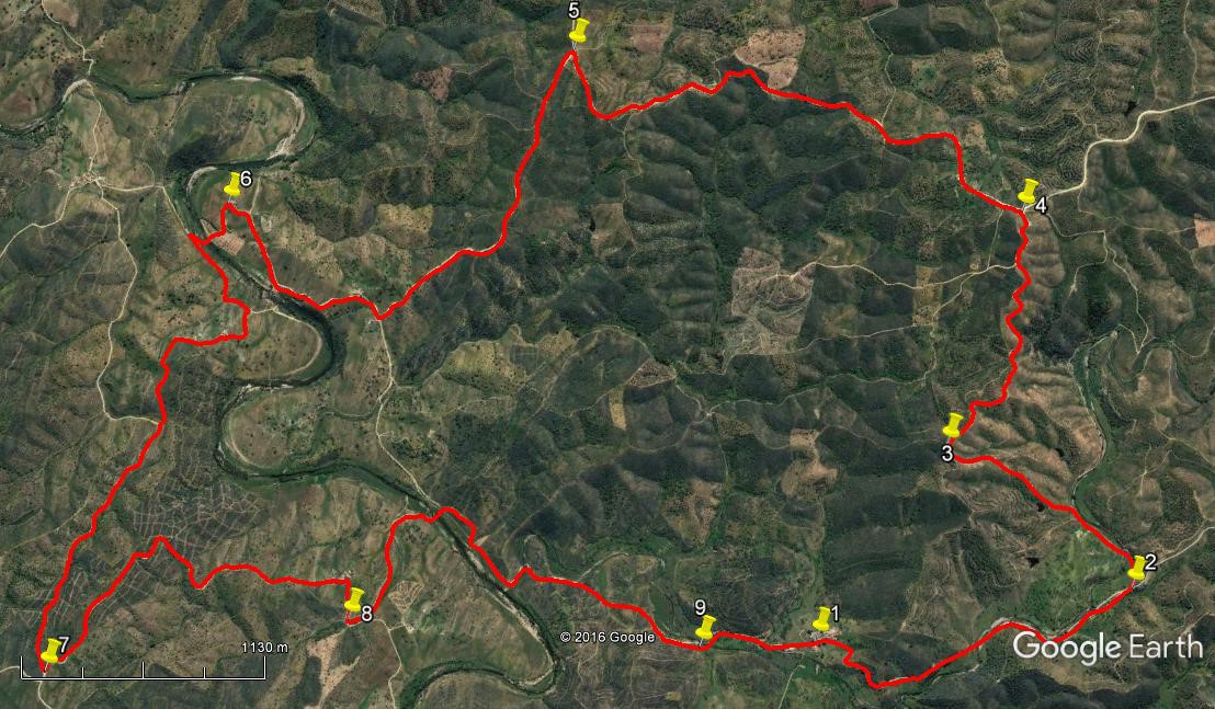
- From the middle of Revezes, (1) walk back along the road you have just driven for around 1.82k. After crossing the river, look for a turning off on the left after 860m, (2) going down to the river, and take this path. Cross the stream and walk alongside it for about 330m, then take a track heading north-east uphill quite steeply. See a small barragem or dam on the left after 170m, and continue up to a high point 760m from the river (3).
- Swing round to the right here and walk generally south-eastwards over the next 1.55k, on an undulating and winding path which rises to a new high point at the end. (4) (Ignore a turn to the left after 1.25k.) Turn left and start to descend by stages, passing through the small settlement of Val da Moita on a course just east of north for the next 2.78k. The track rises again slightly towards the end of the section to reach (5).
- Turn left at the junction and begin to descend northwestwards to reach a junction after 1.73k, facing a ruined building down a track. Turn right and make your way past a farm building on the right, down to a point close to the river. * Do not cross here, but turn half right to climb gently to the tiny settlement of Monte Branco (6) after a further 1.13k. Swing left after the buildings to follow the track down the hill and across a grove of trees to the riverside. If the river is running too high you need to retrace your steps to the asterisked point and cross at the ford. This river, the Vascao, marks the boundary between the Algarve and the Alentejo – you are now in furrin parts!
- Walk up to the main track on the opposite side using the diagonal footpath, then turn sharp left to walk along the broad track, following it for 510m to come to a junction with a track on the right, opposite the ford. Follow this new track uphill as it turns north, passes two sets of farm buildings and then turns north-west, climbing still, then dropping into a hollow to meet a track on the right in the depression after a further 930m. Carry straight on northwest past the junction for a further 1.33k, rising steadily all the way, to arrive at a junction with a track coming in from the left, with a small barragem visible down to the left. (7)
- Turn sharp left and follow the track on more or less level ground for around 650m south-east, before it turns to descend south-west, then back north-west for a short time after to small settlement of Corvos to arrive at a junction with a track on the left after 1.38k. (8) Turn left down to the river and cross, on the stepping stones if necessary. Then turn right along the river for 550m before turning away to follow the track very gently uphill to the crossing of a small tributary stream after 1.2k. (9) Now simply follow the track parallel with the stream on the right to get back to Revezes after a further 630m.

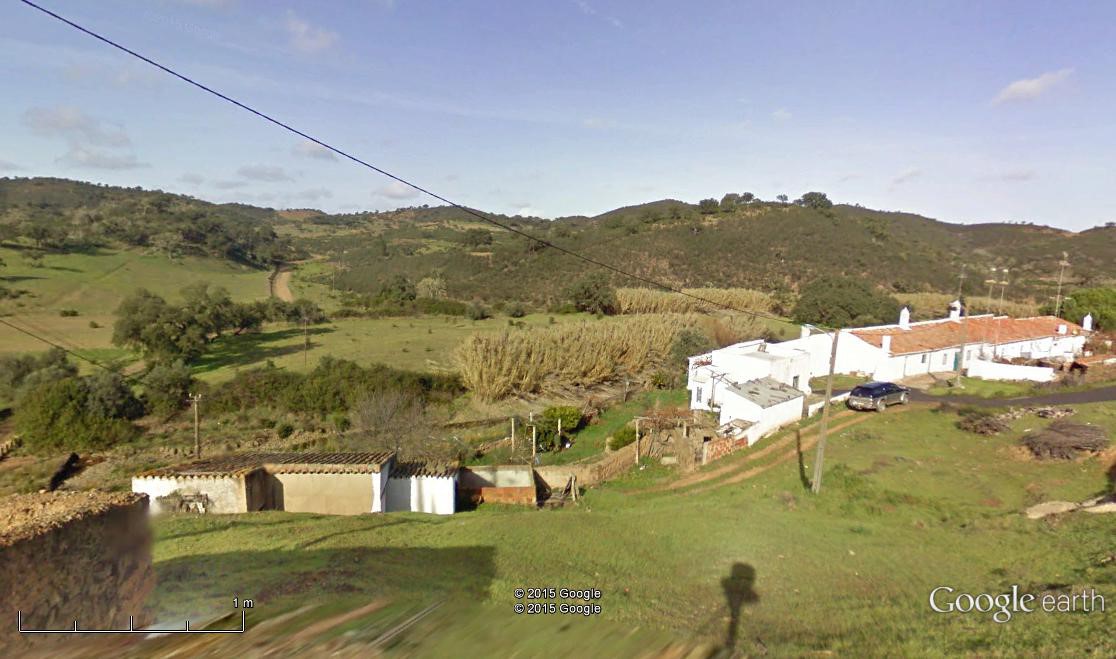
Revezes.
Orientation: Left is north. 37/ 7
GPS Points:
| 1 | Revezes | 23 | 33 | 94 | 56 | 44 | 89 | |||
| 2 | Fork left | 22 | 45 | 46 | 56 | 59 | 27 | 1.82k | ||
| 3 | Top of loop | 23 | 04 | 29 | 56 | 19 | 16 | 1.27k | ||
| 4 | High point | 22 | 39 | 93 | 55 | 42 | 92 | 1.55k | ||
| 5 | Hairpin | 23 | 33 | 94 | 54 | 40 | 60 | 2.78k | ||
| 6 | Monte Branco | 24 | 33 | 37 | 54 | 41 | 23 | 2.86k | ||
| 7 | Turning point | 25 | 25 | 23 | 55 | 52 | 99 | 3.13k | ||
| 8 | Turn to river | 24 | 40 | 25 | 56 | 06 | 61 | 2.21k | ||
| 9 | Before Revezes | 23 | 51 | 13 | 56 | 37 | 94 | 2.49k | ||
| End | 630m |

