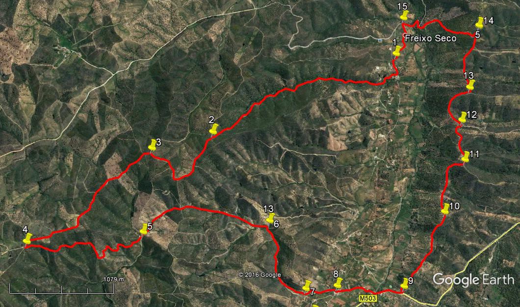
Walk Thirty Eight. Freixo Seco. 15.7 kilometres. Ascent: 720 metres
GPS: 37/16 05 56 8/03 22 82
This is a challenging walk, not so much for the distance but for the fact of a ridge walk in the second half which includes three or four quite demanding ascents. It starts from the hamlet of Freixo Seco, climbs steadily and increasingly steeply up a long valley onto a high ridge. After traversing part of the ridge, it doubles back into the valley to the bar at the settlement of Tameira. Crossing the valley, the trail follows the ridge eastwards (including the steep ascents ) towards the high summit of Monte Negro. Avoiding this final climb, the path returns to the valley and back across to the start/ finish point. Refreshments only at Tameira.
Getting to Freixo Seco.
The easiest way to get to the start is from the N124 at Salir. Travel there either along the 124 from Silves/ Messines, or north from Loule. Come to the roundabout on the 124 below Salir and go straight on (Coming from Loule turn right). Take the third turn on the left after the roundabout, signed to California, among other places. Follow this road as it leaves the Salir valley and cuts through a pass over into the next valley north. Arrive at a fork in the road, signed to lots of places, including Freixo Seco. Turn left into the valley, cross the bridge at the bottom and take the second turn on the left. (The first is just a narrow track).Reach the first turn on the left, and go down a short distance to park on the rough ground, leaving the track clear.
At Freixo Seco.
The Walk.
- From the parking area, walk up to the tarmac road (1) and turn left. Take the second turn on the right up a concrete road with a house end on the left. (180m) Walk up just past a turn on the left to a house, and take a track on the left that winds northwest over a low rise and drops down into a fairly shallow valley. Turn right up the valley. (Don´t cross the stream) (290m)
- Continue along this track up the valley, as it rises very gently at first, becoming increasingly steep as you climb. Ignore all small tracks down to the right or up left. Come to a junction with four options, after 2.5k from the start. (2), Take the track heading roughly in the same direction as the one you are already on (north-westerly), and continue to climb.
- Swing round, briefly north, then north-east, avoiding turns on the left, to reach a ridge at a T junction. (1.1k) (3)
- Turn left along the ridge track and follow it, avoiding all turnings on either side, heading north-west and then almost due north. See some old buildings ahead and a small lake off to the right, and arrive at a track junction, with a wide dirt track leading off down to the left round a hairpin bend. (4) (1.7k)
- Follow this track as it descends steadily, roughly due south for a time, then round quite a sharp curve to trend more south-east to reach a track in the valley coming gently up from the right. (5) (Stream crossing here after rain) (1.61k)
- Turn left here and begin to climb again steadily, continuing roughly south-east, then turning due south to reach a crest. From here begin to descend once more, veering a little west of south, then due south to reach another junction. (6) (1.59k) Another water crossing possible here.
- Turn right here and walk on virtually level ground before descending gently once more. As the valley opens up to the south, find a narrow path forking off downhill on the left through trees, and take this down to a junction with a concrete road (7). (940m) A further stream crossing possible.
- Turn left, walk round in front of houses, then turn right at the next junction, continuing to walk gently downhill to yet another junction in a settlement, with garage doors facing you. (380m) (8) Turn left and walk along, dropping down to a main road, with a bar on the right. (450m) This is Tameira.
- To continue, walk up the main road (not the one on the left), go just over the rise and find a lane leading off uphill on the left. (310m) (9)
- After a few metres, turn off to the left on a track which quickly turns right and leads uphill onto a ridge. It runs south-easterly for a time, then due east, leaving a low hill to the right, then rising fairly quickly to a summit. (1k) (10)
- It then runs on fairly level ground for a time, before swinging due south to climb steeply to a second summit, (730m) (11) before turning east again and then north east to descend to a depression. A path running north – south crosses at the low point. (500m) (12)
- Go straight across and follow the path round a wide semicircle to the north, climbing steeply again to a second high point. Ignore a track going right as you come off the summit (570m) (13), unless you wish to visit the ruined mill and see the view.
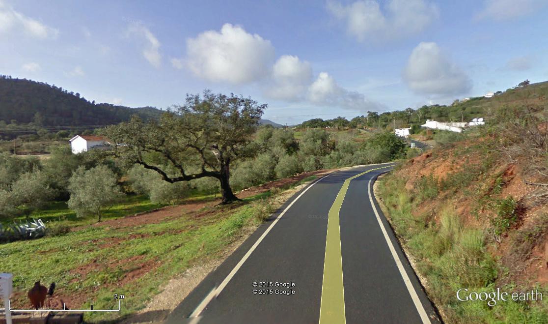
- Now follow the track eastwards down into a hollow. Bear left at the bottom to go up a short, very steep rise, going left at the top to curve round right, rising quite steeply once more towards another high summit ahead. Before reaching the base of this peak, see a path going down to the left bending round to the left, (720m) (14) and follow this as it descends quite steeply to meet a tarmac road at a bend. (710m) Turn left down the road, following it to the valley floor and across a bridge. Take the first turn on the left after the bridge (280) (15) and follow the narrow road as it winds through the settlement of Freixo Seco. Go to the right of the first large building to stay on the roughly paved road. As you leave the last building behind on the right, go round a curve uphill to reach your parking area. (500m
Orientation: North is left.
GPS Points. 37// 8
| 1 | Freixo Seco | 16 | 04 | 56 | 03 | 22 | 82 | |||
| 2 | Track near ridge | 17 | 04 | 37 | 04 | 09 | 56 | 2.67k | ||
| 3 | At ridge | 17 | 23 | 85 | 04 | 19 | 82 | 1.1k | ||
| 4 | Turning by lake | 18 | 01 | 48 | 05 | 06 | 65 | 1.7k | ||
| 5 | Track junction 1 | 17 | 23 | 94 | 04 | 56 | 72 | 1.61k | ||
| 6 | Track junction 2 | 16 | 40 | 95 | 04 | 44 | 15 | 1.59k | ||
| 7 | At farm | 16 | 25 | 16 | 05 | 11 | 43 | 940m | ||
| 8 | At garages | 16 | 14 | 41 | 05 | 08 | 50 | 380m | ||
| 9 | Turn off main road | 15 | 51 | 35 | 05 | 04 | 49 | 760m | ||
| 10 | Hill to right | 15 | 41 | 46 | 04 | 29 | 57 | 1k | ||
| 11 | First summit | 15 | 36 | 96 | 04 | 05 | 89 | 730m | ||
| 12 | North-south path | 15 | 39 | 28 | 03 | 48 | 77 | 500m | ||
| 13 | After second summit | 15 | 38 | 54 | 03 | 34 | 28 | 570m | ||
| 14 | Before Monte Negro | 15 | 38 | 22 | 03 | 07 | 13 | 720m | ||
| 15 | Turn to Freixo Seco | 16 | 03 | 47 | 03 | 06 | 22 | 990, | ||
| End | 500m |