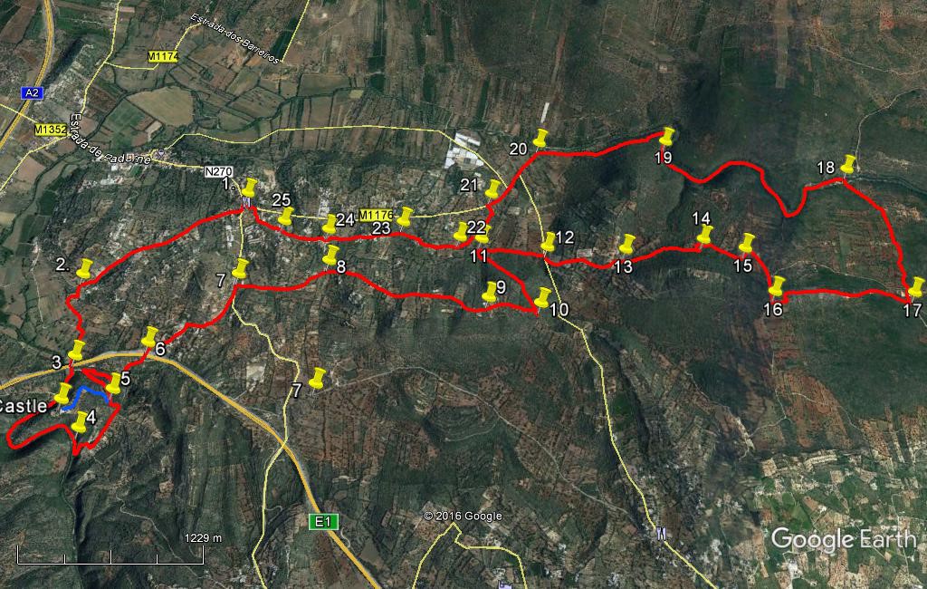
Walk Thirty Two. Cerca Velha Circular. 21.2k Ascent: 545m
GPS: 37/10 26 84 8/11 32 45
A long but not too strenuous walk out from Cerca Velha, near the small town of Paderne, taking in the ruined medieval Paderne castle and the beautiful gorge that runs beneath it, followed by a trek eastwards over hills and valleys, and a return walk down the splendid gorge of the Rio Algibre, ending with a stroll through attractive small hamlets. Refreshments only at the start and finish.
Getting to Cerca Velha.
From the south, the easiest way is from the N125 at the junction with the N395 Albufeira – Paderne road. GPS: (37) 07 07 59 (8) 14 46 39. Follow the 395 north through Ferreiras and passing over two motorways, to arrive just north of Paderne in the settlement of Purgatorio. Turn right here to cross the river into Paderne and follow the main road through and up the hill out of the town. When the road levels out, look for the bar-restaurant ´O Alagar´ with its distinctive yellow awnings, on the left. Best parking just before it on the right.
From the north, and west, follow the N124 past Messines and up the hill after the A2 motorway exit. Come to a small roundabout and turn right for Paderne on the N270. Arrive at Purgatorio and turn left across the river, then follow as from the south above.
The Walk.
- With your back to the bar, (1) turn left and walk for 100m before taking the first turn on the right, along a narrow tarmac road. Follow this road between houses and then into more open country descending steadily southwest, passing several turnings on both sides. After 1.22k, pass a turn on the left rising gently, with a 3.5ton warning sign. Take the next turn left down a narrow gravel lane between low walls, (2). Go down here turning right after a house and swinging round in a semicircle to walk southeast then south to arrive at a T junction. (440m from 2) Turn left and then quickly right, then walk down and under the motorway viaduct ahead. (340m) (3)
- Go straight ahead after the viaduct, following a path alongside the river. At the weir on the river you can cross if you wish and if the water level allows, as there are paths on both sides of the river. Follow your chosen path as it describes a curve, following the line of the river through a gorge. Arrive at a bridge (Roman origins) (1.2k on the inner curve, longer on the outer) (4) and cross if you crossed the weir earlier. Go straight on (or turn right) and climb on a wide rocky path, round a hairpin and up to a T junction. Turn left and walk over the rise, down gently to a sharp left-hand bend. (5) 100m further on see a fork off to the left. (580m) This will take you up to the castle ruins if you wish to view them. Then you must return to this spot. (Round trip is 1.14k, shown by the blue line)
- To continue, go downhill to the valley floor and round the hairpin bend at the bottom, continuing ahead on this track that leads up to the side of the motorway. Cross the motorway on the bridge (6) and follow the tarmac road up into the small settlement of Barradinha. At a right-hand bend with post-boxes opposite, go round to the right and continue up to a main road. Cross over here and walk for a short distance to find a narrow lane on the right, leading uphill to the right of a large house. (7) (990m from 6). Follow this path first of all due east and then north-east as it rises, levels out and rises again over some 730m. The surface becomes tarmac and then joins another tarmac road shortly afterwards at a corner junction. (8) Bear right here along the road.
- The road dips a little and then rises. Very soon on the right pass the lane to the Corte Real Gallery, a noted sales and exhibition space (open Thursday – Sunday). The lane climbs quite steeply from here for a time, gradually levelling out and affording excellent views to the left. The route crosses over the dome of the hill, always heading more or less due east, for around 1.3k, before beginning to descend quite steeply (9). After around 400m, the track turns quite sharply south to face up a valley. After a further 50m or so, find a track turning back northwards on the left, rising. (10). Take this track as it climbs, levels and then descends (a little overgrown in places) over some 750m, to come down to a junction in the valley. (11) Turn right.
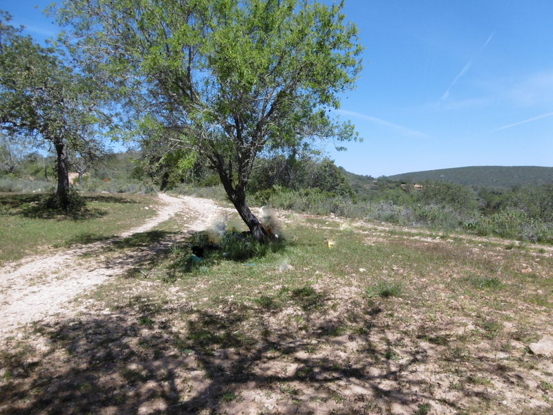
- The track starts out clearly, but peters out after around 140m. Stay as close as possible to the line of bushes marking the base of the hill (more or less due east) for the next 360m, to emerge onto a tarmac road. (12) If you are in the right place, there will be a stony lane more or less opposite, leading off south-eastwards to begin with. Follow this lane as it climbs fairly gently but then a little more steeply. Go left at a fork and follow for around 620m up to an open space dotted with trees, on a low saddle. (this is a good lunch spot if you have one planned) (13).
Lunch spot.
- To continue, take a track leading off from the clearing on the right, heading roughly northeast. (Another track, just to the left of this one, heads down into the valley - make sure you take the upper one.) The track rises for a time, levels out and descends again. Ignore a clear turn to the left downhill after 360m, and now climb and descend with the track once more. Near to the top of the rise, pass close (on the right) to the ruins of an old lime-burning pit, where the raw material was prepared for the limewash or cal that was used to paint houses. As it begins to descend, the track goes round a hairpin bend (14) to the left, and ends up on the valley floor, facing eastwards once more. The track once again peters out after around 200m, but head east as ever to find the end of another track (15) after a further 150m, leading up to a wide dirt road.
- Turn right along the road, heading southwards for around 490m, ignoring one obvious turn left and taking the second in a heavily wooded area. (16) A few metres into this new track turn left and follow as the track begins to rise steeply. Follow it as it first levels out then rises again, up and over a conical hill, descending steadily down to a very wide sandy dirt road after 1.15k. (17). Turn left along this road and follow it almost due north for around 850m. At a junction it bears rather more north-westerly and continues for a further 380m to reach the side of a river. (18) This is the Algibre, which is sadly very often dry. Do not cross the river (see a tarmac surface on the other side), but turn left to walk along the southern bank. After crossing open meadow, the land closes in around the path, and it becomes a single-file track winding with the river through a deep gorge over some 2.12k.
- At the end of this narrow gorge, the path broadens a little (19), and the land opens out. The track climbs away from the river and then descends again, leading finally to a junction with a tarmac surface with a large house on the right. (20) (1.33k from 19. Turn left here to walk along a tarmac road for 650m, passing two tarmac junctions, one left, one right. Before the next tarmac road on the right, on a gentle rise, find a track crossing the road and turn left along it. (21) After 100m fork right to head across the valley and up the gentle slope, roughly north then north-east, to reach a track coming in from the left (22). Turn right to walk into the hamlet of Casas do Poco.
- Turn right at the first junction in the village, then follow as it bends first right, then left, to move out into open country again. 160m after the last bend fork left off the road (23) at a corner, walking generally northwest on a very indistinct track that slowly becomes more visible and ends up under trees. Emerging onto another road in a second hamlet, Aldeia Pequena. Walk straight ahead up the road through this settlement, and at the end of the houses continue straight across onto a narrow track across fields. After another 230m, enter a third settlement, Aldeia Grande. (24) Turn right, left and right again to continue on a tarmac road in the same broad direction. After another 320m, bear right (25) at a fork and descend, joining another road after a further 350m. Turn left here to drop the remaining few metres to the main road, with the bar on the right.
Orientation Normal.
GPS Points 13/ 8
| 1 | O Alagar | 10 | 26 | 84 | 11 | 32 | 45 | |||
| 2 | Turn to river | 09 | 56 | 05 | 12 | 12 | 03 | 1.41k | ||
| 3 | Under motorway | 09 | 36 | 45 | 12 | 03 | 81 | 800m | ||
| 4 | Roman bridge | 09 | 20 | 78 | 11 | 53 | 72 | 1.28k | ||
| 5 | Castle visit | 09 | 30 | 97 | 11 | 48 | 30 | 550m | ||
| 6 | Motorway crossing | 09 | 43 | 53 | 11 | 44 | 23 | 1.61k | ||
| 7 | Monte Novo | 10 | 04 | 88 | 11 | 25 | 23 | 920m | ||
| 8 | Nr Corte Real | 10 | 13 | 19 | 10 | 59 | 36 | 720m | ||
| 9 | Start of descent | 10 | 12 | 65 | 10 | 09 | 57 | 1.32k | ||
| 10 | Hairpin left | 10 | 15 | 02 | 09 | 54 | 09 | 430m | ||
| 11 | Valley floor | 10 | 29 | 24 | 10 | 16 | 49 | 750m | ||
| 12 | Tarmac road | 10 | 31 | 10 | 09 | 55 | 99 | 520m | ||
| 13 | Clearing | 10 | 34 | 58 | 09 | 32 | 33 | 660m | ||
| 14 | Hairpin to valley | 10 | 42 | 64 | 09 | 09 | 38 | 630m | ||
| 15 | Turn to main track | 10 | 41 | 82 | 08 | 56 | 19 | 450m | ||
| 16 | Foot of hill | 10 | 32 | 02 | 08 | 46 | 03 | 610m | ||
| 17 | Far end of hill | 10 | 40 | 01 | 08 | 04 | 89 | 1.15k | ||
| 18 | At river | 11 | 12 | 50 | 08 | 26 | 54 | 1.23k | ||
| 19 | End of gorge | 11 | 09 | 32 | 09 | 25 | 70 | 2.14k | ||
| 20 | At tarmac | 11 | 00 | 83 | 10 | 06 | 42 | 1.32k | ||
| 21 | Turn off road | 10 | 42 | 78 | 10 | 17 | 07 | 640m | ||
| 22 | Junction before village | 10 | 28 | 13 | 10 | 23 | 29 | 520m | ||
| 23 | Turn on faint track | 10 | 28 | 40 | 10 | 42 | 63 | 480m | ||
| 24 | Aldeia Grande | 10 | 21 | 34 | 11 | 04 | 90 | 600m | ||
| 25 | Turn downhill | 10 | 21 | 10 | 11 | 17 | 57 | 340m | ||
| End | 450m |