Walk x20. Monte da Gorda Circular. 19.5k Ascent: 750m
GPS: (37/8 18 35 97 // 47 06 42
The tiny hamlet of Monte Gorda lies just southeast of the western Algarve town of Aljezur. The walk covers a hilly area to the southeast of this point, involving a mix of ridge and valley walking, and sight of the work that has been going on in recent years to reforest an area devastated by fire. There are no refreshments on the route - the best plan is to have coffee in Aljezur before driving to the start.
Getting to the start.
Getting to Aljezur from the east is a bit of a trek, but it has been rendered much easier by the A22 motorway. The easiest route is to follow the motorway to the end at Bensafrim, and then take the N268, signed to Aljezur. In the centre of Aljezur, follow the main road across the river, and at the roundabout turn right onto the N267, signed to Marmalete and Monchique. After 1.6k, see a sign on the right for Casa Alva, and turn down the lane. Park where the road curves to the left after 200m. This is the start of the walk.
The Walk.
The Start, near Monte da Gorda.
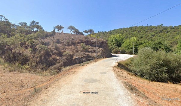
From your car (1), follow the lane towards the hamlet of Monte Gorda over to the left, but stay right at the first fork to avoid going into the settlement. Stay left at a second fork after around 400m, climbing very gently. After another 550m, the track turns right and then left, with Casa Alva across the other side of the valley floor. Continue due south for just over 800m, passing a farm with long sheds behind it on the left. Come to a fork with more houses on the hill to the left, and take the right hand option, continuing south-southwesterly. (2) Walk in the valley for another 800m, passing more houses on the left.Come to a junction, and stay right (3) Turning left here would take you to a distillery producing medronho, the local firewater.
Continue in the same direction, still in the valley, but climbing a little more steeply now, for another kilometre, passing a couple of belts of trees. At the end, go round a right-hand arc, and immediately after the bend taking you out of it, turn off the main track at a fork on the right (4). This takes you slighly downhill, round a tight right hand bend, and then up very steeply with a terraced hillside on the left, and trees on the right. After about 130m, the gradient eases, and the track continues southwesterly, with descending terraces on the left, and open plateau on the right, for another 300m.
Arrive at junction and turn left (5) on a broad track, heading first south, then southeast, with rising land to the right, and a descent to the left. After about 600m, the track rises a bit more steeply to a small summit, then swings right and descends a little to a fork (6). Take the left hand option, and walk southeasterly for just over 1k, with terraced land all round, in a rolling landscape. The track rises slowly, then a little more steeply, reaching a summit, then turning south and dropping slightly. Pass a point where a track crosses yours at an acute angle (7), and continue south.
Now your track describes a wide arc, with a steep drop on the left, and more rolling land to the right. Work round, keeping to the same track, and seeing the heads of three valleys dropping away on the left, as you come to face eastwards, then southeast. After 1.5k, arrive at a fork with a track heading up to the left (8), and stay right, keeping to your original track. Pass an isolated property with a geodesic dome on the right, still climbing gently, and soon afterwards the track turns almost due south. 200m after the turn, arrive at a junction with a track turning sharp left, and take this one, (9) heading more or less due east along the edge of terraced and planted land. Stick to this edge for the next 1k, with descending ridges and valleys to the right.
At the end of this section, the track rises a bit more steeply, and then swings to the left (10), still following the edge of the plantation. Now heading north, the track rises and falls over another 1k, dropping quite steeply at one point, but all the time skirting the edge of planted land on the left. Arrive at a multiple junction with an island of trees in the middle, and skirt round to continue straight ahead. (11). Briefly with planting on both sides, then with a deep valley on the right, continue northwards over undulating ground for another 1k. Come to a junction at a summit and turn right (12), to descend quite steeply, and then to resume the same undulating course, but heading now more northeasterly.
After another 1k, come to a junction at the head of the valley on the right (13), and turn left, heading north once more. Climb steadily from here for another 800m, now on a ridge. Come to a junction with a track coming in from the left (14), and continue ahead, now on more or less level ground. Stay on the ridge as it turns a little more to the northeast and begins to descend very slightly. At a fork after 650m, (15) take the right and descend very slowly, with a small barragem on the right below. Then rise quite steeply over a short distance to emerge close to a tarmac road (16). Turn left.
Avoid the tarmac by taking a track running parallel with it. After 300m, it turns away from the road, dropping into a shallow depression before beginning ro rise again. Take the left hand at a fork after 600m, and follow the track as it rises for a time, then descends steeply into a valley, then follows the valley, over the next 2.4k, heading more or less northwest. Come to a junction with a broad track heading into a side valley on the left (18), and stay right, heading down steeply again, passing a house with a pool, and yurts behind, and arrive at a tarmac road. Turn left. (19). Follow the road for 800m, then turn left down the lane to your car.
GPS Points.
| 1 | Start | 18 | 36 | 12 | 47 | 06 | 50 | |||
| 2. | Fork right | 17 | 46 | 24 | 46 | 39 | 65 | 1.9k | ||
| 3 | Fork Right | 17 | 22 | 81 | 46 | 27 | 47 | 820m | ||
| 4 | Fork right | 16 | 55 | 13 | 46 | 16 | 34 | 1k | ||
| 5 | Turn left | 16 | 44 | 02 | 46 | 28 | 69 | 550m | ||
| 6 | Fork left | 16 | 24 | 24 | 46 | 11 | 25 | 800m | ||
| 7 | Straight on | 15 | 58 | 26 | 45 | 47 | 69 | 1.1k | ||
| 8 | Fork right | 15 | 32 | 71 | 45 | 21 | 20 | 1.5k | ||
| 9 | Turn left | 15 | 24 | 42 | 45 | 03 | 63 | 600m | ||
| 10 | Curve left | 15 | 30 | 86 | 44 | 29 | 08 | 970m | ||
| 11 | Straight across | 15 | 58 | 40 | 44 | 24 | 27 | 1k | ||
| 12 | Fork right | 16 | 25 | 92 | 44 | 30 | 32 | 1k | ||
| 13 | Stay left | 16 | 45 | 10 | 44 | 14 | 92 | 960m | ||
| 14 | Turn right | 17 | 07 | 39 | 44 | 25 | 55 | 780m | ||
| 15 | fork right | 17 | 25 | 88 | 44 | 21 | 86 | 650m | ||
| 16 | Turn left | 17 | 30 | 02 | 44 | 09 | 25 | 320m | ||
| 17 | Fork left | 17 | 49 | 96 | 44 | 32 | 53 | 900m | ||
| 18 | Turn right | 18 | 18 | 26 | 45 | 55 | 59 | 2.4k | ||
| 19 | Turn left | 18 | 33 | 42 | 46 | 25 | 20 | 910m | ||
| END | !k | |||||||||